Watersheds under the roof: Western Sudetes mountain huts as a lesson in the rivers between the Oder and the Elbe
On the verandas of Stóg Izerski, Hala Szrenicka, Szrenica and Wysoki Kamień you can literally see how Europe’s waters diverge. This guide teaches you to read the ridges and valleys of the Western Sudetes through the prism of two seas: the Baltic and the North Sea.
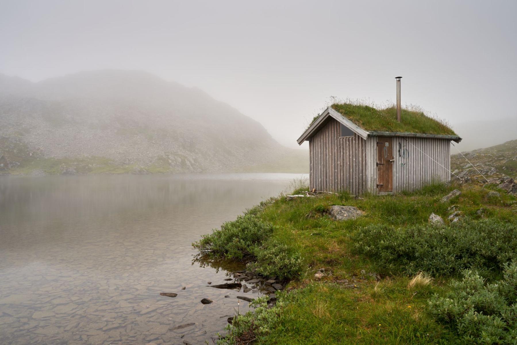
The first raindrops tap the shingles, resin smells stronger, and the wind from the ridge brings a cold susurrus of the forest. On the threshold of a mountain hut it is enough to lift your gaze: on one side streams flow to the Oder, on the other — to the Elbe. A watershed stops being a line on a map. It begins here, under the roof.
Map under your boot: where the watershed really runs
A watershed is a natural boundary between catchments — on a ridge a drop of water “decides” which way it will go. In the Western Sudetes the stakes are high: it separates two great European basins — the Baltic Sea (via the Oder) and the North Sea (via the Elbe). The Karkonosze ridge forms the physical, clearly legible line of that boundary on the ground[1]. ([en.wikipedia.org])
In practice this means that standing on the Karkonosze crest you see two hydrological worlds. The northern slopes feed mountain tributaries of the Bóbr and onward to the Oder; the southern ones — streams running toward the Elbe. Just listen: the roar of waterfalls on the Polish side sounds different from the quiet, wide marshes to the south. The mountain divides not only waters but also landscapes.
The red Karkonosze ridge: from Hala Szrenicka to the Elbe
The simplest watershed lesson is led by the red ridge trail — the old border thoroughfare known today as the Polish‑Czech Friendship Road. It runs along the state border, across Szrenica and further toward the Snowy Cirques, the Black Ridge, up to Śnieżka. Along the way you pass Łabski Szczyt — and on the Czech side, on Łabska Łąka, the symbolic sources of the Elbe. It is the moment when “north” and “south” begin to mean something utterly different for the water[2]. ([en.wikipedia.org])
If you pace it sensibly, this lesson is best read from the terraces of the huts. From Hala Szrenicka — with views over a broad grassy threshold and the town below — you can see how short, steep streams carry water toward the Kamienna and the Bóbr. From the crest by Szrenica panoramas open more widely to the south: the afternoon light reveals gentler slopes where rivers have time to meander before they reach the Elbe. Maps don’t teach this — the air does.
Between Stóg and the Hala: the Izera stretch of the European watershed
In the Izera Mountains the watershed does not climb sharp summits. It cuts across vast plateau plains, flat as a table, where spruce woods and peat bogs store water in a sponge of mosses. The most illustrative route begins at the hut just below Stóg Izerski, whose veranda is often a gallery of clouds and light. Heading east toward Hala Izerska you walk as if on a roof: in one direction waters flow to the Bóbr (and then the Oder), in the other — to the Izera, the first large tributary of the Elbe in this part of the Sudetes[3]. ([en.wikipedia.org])
It was here, on the slopes of Stóg, that in the 1990s hydrologists identified the so‑called “Polish Izera spring” — a tiny but significant streamlet on the Polish side that has the characteristics of a principal, longer source feeding the river. That small textbook detail makes the story of the Izera not only a Czech one. Thanks to it a walker understands why some waters from the southern slopes of the Izera Mountains flow to the Elbe[4]. ([en.wikipedia.org])
You usually reach Hala Izerska — flat like a palm‑smoothed hall — in the shade of spruces and under a low sky. The peat bogs are silent — yet they are the best teachers of water’s patience. After rain delicate trickles disappear into the moss, only to later guide a drop either north (toward the Oder) or southeast, into the Izera valley. On a windless morning you can hear two different melodies of streams running in opposite directions.
Polish Izera spring: a small dispute, a large lesson
The Izera/Jizera itself has several sources and a long history of the “first drop” wandering. Establishing the “Polish spring” on the slopes of Stóg did not so much change the course of the river as it ordered its story: a river that many consider “Czech” also has an important beginning on our side of the border. For a field teacher this is a ready example of how the concepts of “source”, “catchment” and “watershed” can be less obvious than they seem[4]. ([en.wikipedia.org])
Wysoki Kamień and the Kamienna: looking into the Oder catchment
A climb to Wysoki Kamień — a rocky, austere point in the heart of the Izeras — organizes the northern half of the puzzle. From its crest (1058 m a.s.l.) you can plainly see a fan of valleys on the Polish side: beyond belts of forest the Jelenia Góra Basin opens, and in the foreground streams run down that will eventually feed the Bóbr[5]. ([de.wikipedia.org])
It is here that the Kamienna is easiest to “read.” It begins high below the Karkonosze ridge and gathers waters on its way from two famous Karkonosze waterfalls — Kamieńczyk and Szklarka — then gives them to the Bóbr, and the Bóbr to the Oder. One panorama closes the whole hydrological chain: mountain stream, waterfall, river, tributary and finally the region’s main artery[6]. ([de.wikipedia.org])
Waterfalls as map footnotes: Kamieńczyk and Szklarka
The Kamieńczyk waterfall, loud as a foundry furnace, squeezes into a rocky throat above Szklarska Poręba. A few kilometres on, the Szklarka drops in a steady fan into a rocky cirque. Both cirques — sonorous, damp, with spray in the air — feed the Kamienna, which lower down becomes a full‑fledged river with wide bends. Further on, in Jelenia Góra, the Kamienna slows, hands its water to the Bóbr, and the Bóbr — now with all the seriousness of a lowland river — leads it to the Oder[6]. ([de.wikipedia.org])
Viewed from the terrace of the hut on Hala Szrenicka or from the threshold by Szrenica, it’s easy to “see”: the violent, short channels on the northern side gather like ribs of a fan into one Kamienna current, which after a few valley bends already belongs to the larger story of the Bóbr and the Oder. It’s a river textbook — only without pages.
Field guide in brief: how to read a watershed from a hut’s roof
- Look for sharp edges and gentle backs. On one side of a ridge glacial cirques and steep thresholds give fast streams; on the other — gentler, spread‑out headwaters. That difference can be visible from the veranda.
- Listen. The roar of a waterfall indicates short, energetic drops — usually on the side that “immediately” hands water to a larger river (here: Kamienna → Bóbr → Oder). A quieter susurrus of marshes and wetlands betrays flat headwaters (here: toward the Izera → Elbe).
- Watch the peat bogs. In the Izera basins spongy mosses thin out along the watershed line. It is there that a drop decides its “citizenship”.
- Use a simple experiment. Scatter a handful of small cones evenly along a ridge: some will fall north, some south. Water does the same.
Routes that teach
1) Stóg Izerski → Hala Izerska. Start beneath the hut on Stóg Izerski. A narrow path runs through spruce forest, then the terrain opens wide above the Hala. Halfway stop on a flat expanse: you can see how northern hollows draw water to the Bóbr, and southern ditches to the Izera. This is the purest “plot” of a watershed on the ground[3][4]. ([en.wikipedia.org])
2) Hala Szrenicka → Szrenica → environs of Łabski Szczyt. The red ridge trail leads above the Kamieńczyk gorge to wide terraces with views over the Polish valleys. Further on, the closer you get to Łabski Szczyt, the clearer the awareness grows that on the other side of the ridge the sources of the Elbe await — and its whole basin all the way to the North Sea[2]. ([en.wikipedia.org])
3) Wysoki Kamień — a panorama exercise. From the granite blocks of Wysoki Kamień you can see the frame of the Kamienna valley and the place where the river gathers “footnotes” from Kamieńczyk and Szklarka, then disappears lower into the Bóbr. Few viewpoints explain the Oder catchment pattern so concisely in a single frame[5][6]. ([de.wikipedia.org])
Glossary under your boot — for parents, teachers, photographers
Watershed. The line separating catchments, usually running along ridges. In the Karkonosze it divides the basins of the Baltic (via the Oder) and the North Sea (via the Elbe)[1]. ([en.wikipedia.org])
Catchment (drainage basin). The area from which waters flow to a single river and onward to the sea. The Bóbr’s catchment includes, among others, the Kamienna, and in turn feeds the Oder[6]. ([en.wikipedia.org])
Source. The place where a river begins. The Izera has several spring sites; the so‑called “Polish spring” on the slopes of Stóg helps to order its course on the Polish side of the mountains[4]. ([en.wikipedia.org])
The most beautiful thing about this lesson is that it does not end with definitions. You stand on the hut’s threshold, a cup of tea steaming in your hand, and beyond the railing the waters of two seas diverge. Europe suddenly becomes very small — and very legible.


