From Rails to Gondolas: How Infrastructure Has Changed the Way to the Shelters of the Izera and Giant Mountains
Stóg Izerski by gondola or Wysoki Kamień by rail? It is not merely a choice of transport, but a decision about where the mountain experience begins. We compare four models of access: gondola, railway, lift combined with a trail, and a road leading to a settlement.
Stóg Izerski by gondola or Wysoki Kamień by rail—the choice says more about the day you have planned than the name of the mountain shelter itself. In the first scenario, part of the ascent disappears thanks to the cableway; in the second, the train brings you close to a mountain town, but the trail still has the final say. Hala Szrenicka presents an intermediate model, where the lift, walking routes and winter infrastructure overlap. Jizerka works differently again: a road reaches the mountain settlement, but does not turn it into an ordinary car park beside an attraction.
In the Izera and Giant Mountains, infrastructure is not an accessory to a hike. It defines the threshold of effort, distributes movement across the landscape, influences where people stop for a meal and whether a mountain shelter is the destination, a way station or simply one point along a longer route. That is why the question “how do I get there?” can be too narrow. The more interesting question is: what happens to a place when we cover part of the way by train, gondola or car?
Stóg Izerski: the gondola as a new beginning to the trail
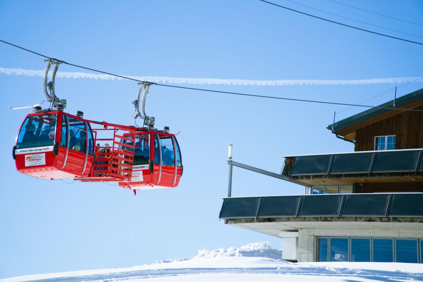
The gondola lift to Stóg Izerski began operating in 2008. Its route is approximately 2.17 km long, and the upper station is located at around 1,060 metres above sea level; the system operates year-round, providing access for skiers, walkers and cyclists.[1]
This changes the basic geography of an outing. At the PTTK shelter on Stóg Izerski, the day no longer begins solely with a long ascent from the valley. For many people, the mountain day starts only at the upper station: the shelter, the ridge and the trails beyond are just a few steps away. The gondola does not remove the mountains from the plan, but shifts the point at which the effort begins.
In practice, three different ways of using the same area emerge. You can treat the lift itself as the main purpose of a short trip, ride up and return the same way. You can also use it as a lift to the ridge, then continue on foot—towards the mountain meadows, passes and further shelters. The third option is to walk up and ride the gondola down, an appealing solution for those who want to preserve the character of the ascent but do not necessarily want to repeat it on the way back.
Each of these options creates a different kind of crowd. With a traditional approach, the group spreads out across time and space: people pass one another on the trail, rest in different places and reach the shelter gradually. The gondola acts as a concentrator. In a short time, it can carry many people close to the upper station, making the area around the shelter not only a place to stay overnight or rest, but also a mountain reception point.
This has consequences for dining. A facility located beside the upper station must serve both the visitor with a fully loaded backpack and the person for whom the ride up is the attraction in itself. Its offering may therefore be more geared towards rapid turnover, short stops and a broad range of needs than that of a shelter reached by most visitors after a longer walk. This is not a judgement of quality. It is a consequence of location.
Stóg is therefore a good choice for people who want to decide how much mountain they want in their day. The gondola allows effort to be scaled. It does not guarantee an empty trail or automatically lead to a more peaceful experience. In return, it offers something else: the chance to begin a hike high up, without giving up the journey ahead.
Wysoki Kamień: the railway brings you to the town, not the summit
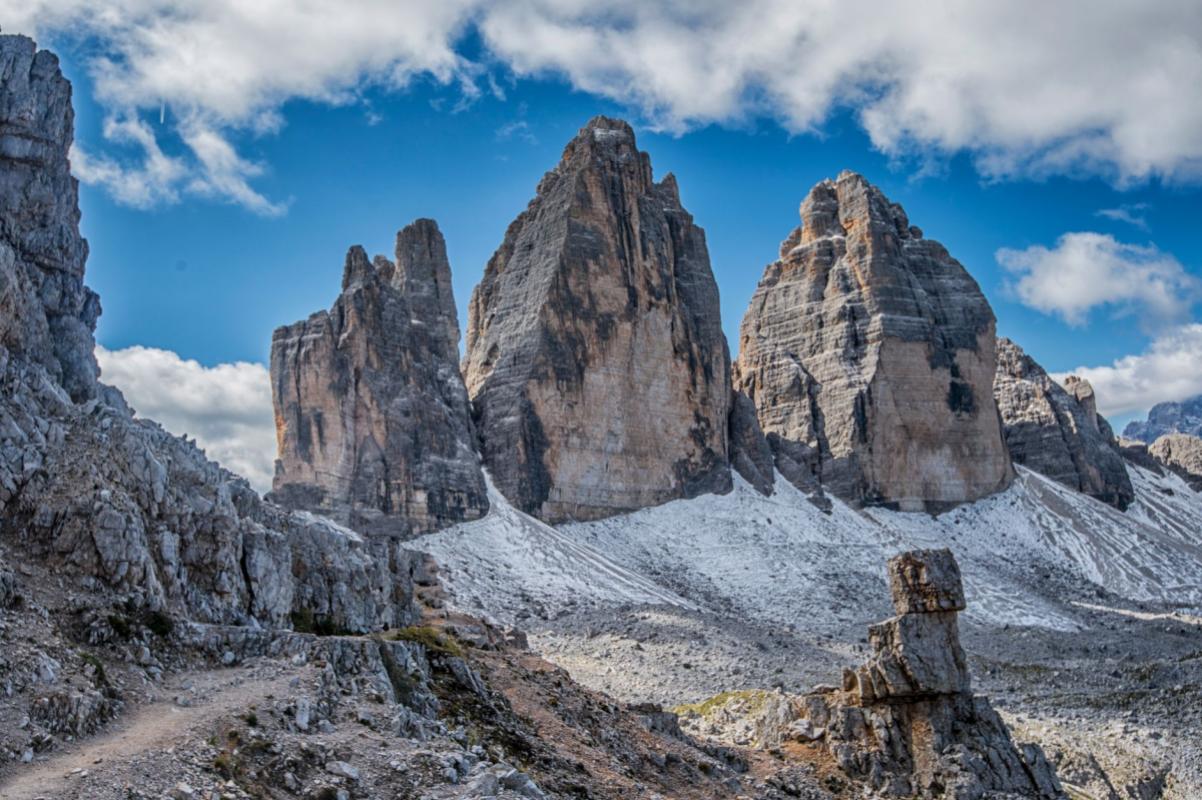
Wysoki Kamień belongs to a different order. A train can bring visitors to Szklarska Poręba, and the Szklarska Poręba Górna station itself has become a viewpoint overlooking the town, Szrenica and Wysoki Kamień. The Main Sudetes Trail runs nearby, but the railway does not end beside the shelter at the summit.[2]
This is an important difference from Stóg. Here, the railway does not directly shorten the ascent to a particular building. Instead, it makes it possible to plan a linear route: arrive by train, set out on the trail, cross Wysoki Kamień and continue downwards—or carry on towards Świeradów-Zdrój. The official description of the route from Świeradów leads via Stóg Izerski, the ridge of the Izera Mountains and Wysoki Kamień, ending at Szklarska Poręba Górna station.[3]
Wysoki Kamień is therefore not an attraction to which you are “dropped off” at the door. The railway infrastructure makes the logistics easier, but leaves the hike as the essential content of the day. For some, this is the most honest compromise between accessibility and the feeling of having reached the summit at their own pace.
The history of the shelter reinforces this character. The former Hochsteinbaude had existed since 1837; the last overnight stays were recorded there in 1963, and the building was later dismantled because of its poor condition. A new private shelter was built by 2010 and currently offers no overnight accommodation.[4] It is a place more closely associated with the approach, the views and a break than with the classic model of a multi-day base on the ridge.
That is precisely why the railway changes not so much the number of people at the summit as the way the day is organised. A visitor can leave the car out of the plan, travel to the town, join the trail and finish somewhere other than where the walk began. For the local economy, this means spending is distributed among the station, the town, shops, restaurants and the shelter. In the gondola model, money and movement are concentrated around the upper station; in the railway model, much of the experience begins before the forest.
Hala Szrenicka and Szrenica: when the lift does not replace the trail
The Hala Szrenicka area presents the most complex arrangement among the places discussed here. The official route of Karkonosze National Park begins on Turystyczna Street in Szklarska Poręba, heads towards the lower station of the lift to Szrenica, then continues via Kamieńczyk Waterfall to Hala Szrenicka and onwards along the red trail towards Szrenica.[5]
The lift is an amenity here, but it does not define the entire outing. You can use the ski infrastructure, walk up, or combine the two. Unlike at Stóg, the upper station is not the sole obvious threshold into the landscape. Hala Szrenicka has its own history, its own facilities and its own position within the network of trails.
Karkonosze National Park describes the Hala as a place where the original small meadow was enlarged in the eighteenth century, and the shepherds’ hut standing there gradually began to receive walkers. The shelter on Hala Szrenicka preserves the continuity of this location, although the present building dates from 1976. Because of its altitude, northern exposure and long-lasting snow cover, the area early became a base for winter sports; ski lifts have existed here since 1949.[6]
This overlap of functions affects the character of the visitors. On a single route, you may encounter people heading to the waterfall, skiers, hikers making for Szrenica, shelter guests and walkers crossing the Giant Mountains on a longer trail. Hala is not merely a place you “walk to”. It is also a hub where different speeds meet.
This setting also changes the meaning of dining. A meal at Hala may be the goal of a short outing, a break before the ascent to Szrenica or a necessary rest after coming up from Szklarska Poręba. The tourist facilities therefore have to operate simultaneously to the rhythm of the trail, the lift and the winter season. Wysoki Kamień lives above all from the fact that you have to walk to it. Hala Szrenicka benefits from the fact that different routes meet here.
Jizerka: a settlement you cannot simply drive into
Jizerka, on the Czech side of the Izera Mountains, is not the equivalent of another gondola station or a shelter beside a lift. It is a settlement whose character depends on the boundary between the road and the walking landscape. By car, it can be reached only from Horní Polubný, and entry is restricted to residents and people staying in the settlement.[7]
This arrangement changes the way you arrive even before the walk begins. The road does not function here as an urban access route to an attraction where the number of cars can be increased indefinitely. First, you have to accept the rules of the settlement, and only then plan your walk. As a result, Jizerka remains a place where transport does not eliminate distance, but defines its final boundary.
This is also a different economic model from that of a shelter on the ridge. Jizerka is a built-up settlement whose houses are, to a large extent, connected with tourism and dining. The point is therefore not a single building handling the flow of walkers, but a small community whose operation depends on how visitors distribute themselves between the road, the buildings and the surrounding routes.[8]
For visitors, this means a more settled experience. At Stóg, the focal point is the upper station and the shelter. In Jizerka, attention is drawn to the settlement as a whole: the way the road ends, the scale of the buildings, the possibility of continuing on foot and the awareness that not every space has to be subordinated to the unrestricted movement of cars.
Jizerka also shows that restricting access does not have to mean cutting a place off completely. You can arrive, but not on the terms of a large resort. You can use the infrastructure, but not expect it to take over all the work of the landscape. It is a subtle difference between “easily accessible” and “without restrictions”.
What does transport do to a mountain shelter?
A comparison of these four places makes it possible to describe the influence of infrastructure without pretending that there is one universal measure of accessibility.
- A gondola lowers the threshold for entering the mountains. Stóg Izerski becomes accessible to people who do not want to—or cannot—begin with a long ascent. The price is a greater concentration of movement near the upper station.
- A railway creates linear routes. Wysoki Kamień does not gain a direct “drop-off at the shelter”, but it gains a connection with the urban system of Szklarska Poręba and the possibility of ending the hike somewhere other than where it began.
- A lift combined with a network of trails creates a zone of mixed speeds. Hala Szrenicka serves walkers, skiers, lift users and those continuing onwards through the Giant Mountains.
- A road to a settlement can act as a filter. Jizerka shows that restricted car access does not close a place off, but affects its scale, rhythm and the way its services are used.
Seasonality takes a different shape in each of these models. The gondola to Stóg operates year-round, so it can attract both winter users of the routes and summer walkers. Hala Szrenicka has a clear connection with long-lasting snow cover and the history of winter sports. Wysoki Kamień remains more dependent on trail conditions and the walker’s decision. Jizerka, meanwhile, is not the destination of a single facility, but a settlement whose accessibility has to be understood together with the restrictions on the road.
The pressures on the landscape also differ. The gondola concentrates people at specific points. The railway disperses them between the station, the town and the trail. The lift creates a multifunctional zone in which walkers and skiers use the same mountain in different ways. The restricted road to Jizerka, by contrast, attempts to hold back some of the traffic before it reaches the centre of the settlement. This does not automatically mean that one model is “good” and another “bad”. Each shifts the burden somewhere else.
How do you choose an experience, not just a route?
- Choose Stóg Izerski if you want to find yourself high up quickly, then decide whether the day should end at the shelter or only after a longer walk along the ridge.
- Choose Wysoki Kamień if the railway is to be the beginning or end of the hike, rather than a lift to the summit itself. This is the option for those who value the logistics of a linear route.
- Choose Hala Szrenicka and Szrenica if you are interested in a mountain hub where trails, lifts, a shelter and the winter infrastructure of the Giant Mountains converge.
- Choose Jizerka if you want to see what a mountain settlement looks like when it has not been entirely subordinated to unrestricted car traffic.
Stóg Izerski and Wysoki Kamień therefore do not compete solely on views or altitude. They represent two different ideas about the beginning of a mountain day: the gondola carries the visitor beyond part of the ascent, while the railway brings them to a place where they still have to start walking. Hala Szrenicka adds a layered model, and Jizerka a model of restriction.
The final choice is therefore not “gondola or walking?”. A more precise question is: where do I want to place the effort—before the trail, on the trail or at the boundary between road and settlement? The answer determines not only the time it takes to reach the mountain shelter, but the entire meaning of that journey.