The Izera Mountains Without a Backup Plan? How to Save the Day When the Parking Lot Is Full, the Bus Is Late and the Weather Changes Your Route
In the mountains, the best plan is not the most ambitious one, but the one you can change without stress. This practical guide shows what to do in and around Świeradów-Zdrój when there is no space at the trailhead, transport no longer fits the route, the weather closes the ridge or your legs refuse to go any farther.
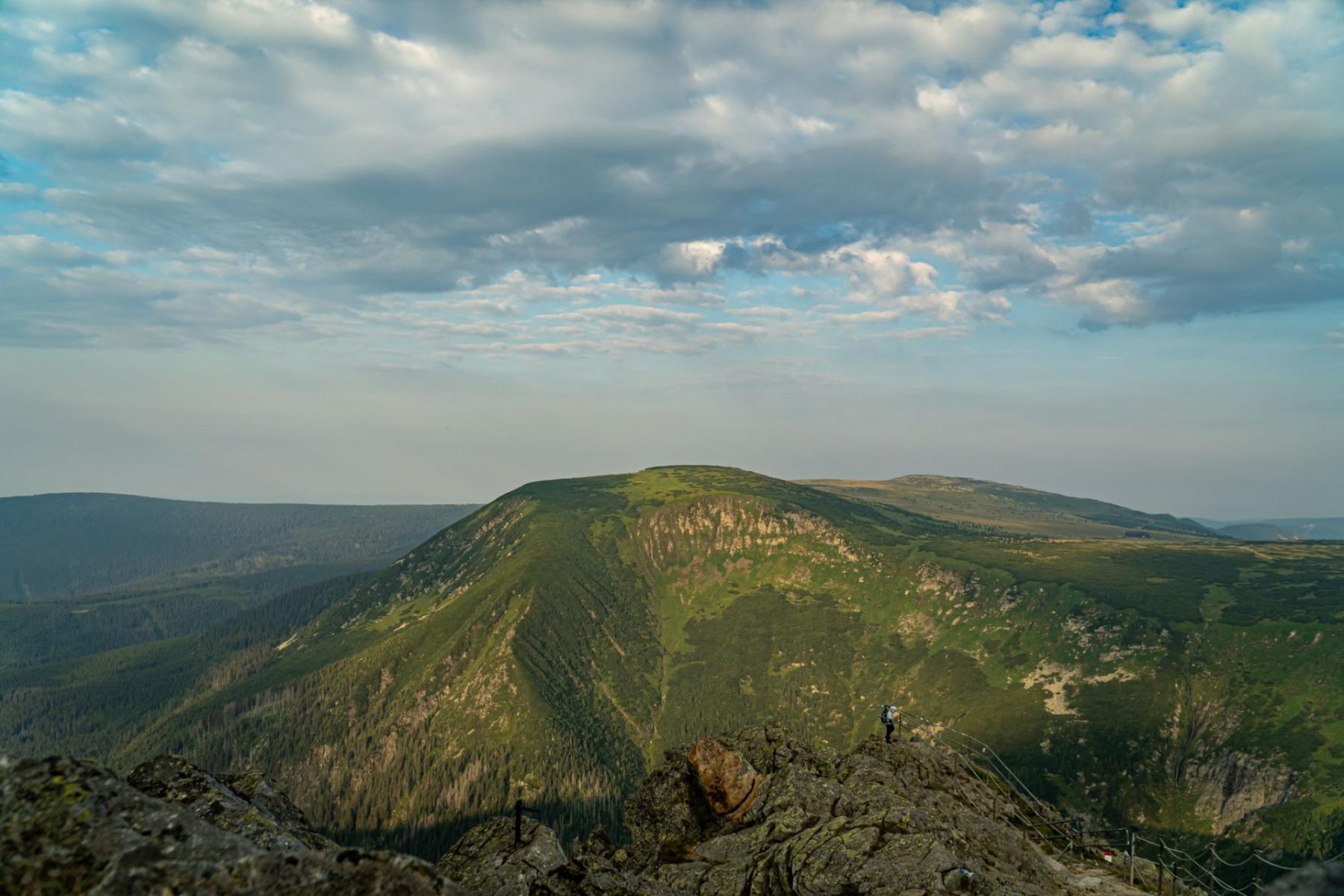
The first test of a successful day in the Izera Mountains sometimes comes before you even reach the trail. The parking lot is full, the app shows that the bus is delayed, and a grey cloud over Stóg Izerski hides everything above the forest. At such a moment, it is easy to start improvising: looking for another parking space, adding kilometres, quickening your pace or stubbornly following a route that no longer suits the conditions.
That is precisely when a backup plan proves useful. Not as a list of ten alternative car parks, but as a simple decision-making system. In Świeradów-Zdrój, it is particularly convenient because many routes begin in town, while the town’s attractions, public transport and trails make it possible to change the character of the day without leaving the area.
The most important rule is this: change the starting point, length or elevation of the route—not your safety.
Before You Set Out: Plan B Should Be Shorter, Not More Heroic
A good plan for a day in the mountains consists of three elements: a place to which you will return, a cut-off time and a route that can be shortened without regret. The last point is often overlooked. Many people save only the name of their destination in their phone—Stóg Izerski, Hala Izerska, Smrek—but do not decide where they will turn back if conditions deteriorate.
Before setting out, agree on three things:
- your base—usually the centre of Świeradów-Zdrój or your accommodation;
- your turnaround time—independent of whether you have reached the summit;
- your shortening point—a clearing, mountain hut, trail junction or bus stop beyond which continuing is no longer necessary.
The town’s official website provides a separate selection of walking routes, including outings to Stóg Izerski and Hala Izerska, as well as shorter options through Zajęcznik, Sępia Góra and Czerniawa-Zdrój.[1] This is an important distinction: you do not have to choose between a full expedition and sitting in the car.
In practice, a simple filter works well. If the problem concerns the car, change your starting point. If it concerns transport, choose a loop that begins and ends in town. If it concerns the weather, descend. If it concerns energy, shorten the route immediately, rather than waiting until someone starts walking several dozen metres behind the group.
If the Parking Lot Is Full: Leave the Car and Move the Start of the Day into Town
The worst response to a lack of parking is to keep circling indefinitely. After a dozen or so minutes, the driver loses patience, the group loses time and the original route begins to require making up the pace. In Świeradów, a better decision may be to abandon the parking area at the most popular trailhead altogether and begin the walk from the centre.
If there is no space at your planned starting point, choose a route whose natural beginning is in town.
The easiest option is Zajęcznik. The town’s official proposal describes this route as a short, family-friendly walk taking about an hour and a half there and back. The beginning leads from the centre through the vicinity of Zdrojowa, Sienkiewicza and Zakopiańska streets, followed by a forest educational trail.[2] It is a good choice for families, couples who do not want to devote the entire day to the mountains, and anyone who arrived later than planned.
If you have more time, you can treat Zajęcznik as the first section of a walk to Czerniawa-Zdrój. The town route leads through Zajęcznik, Czerniawa and the Czarnego Potoku valley, forming a walking loop that takes about three hours. Along the way there are forest sections, meadows and the spa character of the town’s second district.[3] Transport is not necessary if the group has enough energy to walk back; if not, you can check the current public-transport services in advance.
An alternative for those who still want to experience a more distinctly mountainous rhythm is to leave the centre towards Sępia Góra. This route is also included in the town’s selection of suggestions and begins at the Stacja Kultury, a place far less dependent on whether you managed to find a free space beneath your mountain destination that morning.[1]
Do not, however, treat the town centre as an emergency car park for any route. It is more of a new decision point. Before setting off, check whether the shortened version still finishes at a sensible time, whether the group has water and whether the return follows the same route or uses verified transport.
If the Bus Is Late or the Service Has Been Cancelled: Choose a Loop, Not a Jigsaw
Public transport in the mountains is useful, but it should not be the only element on which the success of the entire outing depends. The official Świeradów-Zdrój website provides information on local transport, bus services, taxis and regional connections. At the same time, it directs users to the operators’ current timetables—a useful reminder that times printed in an old guidebook are no substitute for checking a service before setting out.[4]
If the bus is delayed, do not first ask how to make up the time. Ask what you can give up.
- If the delay is minor and you still have time in hand before darkness, shorten the final section.
- If the delay threatens your return, abandon the linear route and choose a walk that begins and ends in Świeradów.
- If you are already in Czerniawa-Zdrój or another locality, do not assume that the next service will arrive in a few minutes. Check the current timetable, contact the operator or choose licensed transport.
The routes most resistant to transport-related surprises are those that start in town and return to town. Zajęcznik, Sępia Góra, a walk through Park Zdrojowy, a shorter option towards Polana Izerska or an outing to Hala Izerska with the possibility of turning back do not require arranging a car at both ends of the route.
For longer journeys, it is worth taking a screenshot of the current timetable in the morning, saving the operator’s number and checking whether a service-change notice has appeared. It is a small task, but one that matters in a place where phone reception can change faster than the weather.
An important distinction: a car park at an attraction or railway station is not automatically an interchange. If your plan involves leaving the car, taking a bus and returning by a different route, each of these elements needs its own confirmation. If one is missing, the safest Plan B is to return to base, not to add another change.
If a Closed Section Cuts Across Your Route: Turn Back to the Last Certain Point
A barrier, tape, sign or clear message that a trail is closed is not an invitation to negotiate. A map may show an old version of the route, while an app may direct you along a path that is closed to traffic that day. In such a situation, on-site signage and the current information provided by the trail manager take precedence.
If you encounter a closure, return to the last place you are certain of, and only there make a new decision. Do not create your own detour through the forest, cut across a bend on a steep slope or go under the tape simply because the destination is not far away.
The simplest retreats are along the route you came. On the route from town to Hala Izerska, Polana Izerska can serve as a turning point. The official description states that reaching Polana from Świeradów takes about an hour and a half, while continuing to Hala extends the excursion to more than six kilometres one way and about two hours of walking.[5] If a warning appears, fatigue sets in or sudden rain arrives, Polana is a logical end to the day—not a failure.
The same principle applies at Stóg Izerski: the mountain hut, a junction or the last section with good visibility can be the place where you end your ascent. There is no obligation to turn every outing into a full loop. In the mountains, returning by the same route is often the clearest and most predictable option.
If the Weather Changes the Route: Leave the Ridge, Do Not Chase the View
In Świeradów, the difference between the town and the higher sections can become noticeable almost immediately. Down below, it may be bright and calm, while higher up there may be fog, wet snow, gusting wind or visibility limited to a few trail markers.
You do not have to wait for a dramatic storm. Three signals are enough: deteriorating visibility, the group becoming chilled or a situation in which you stop recognising successive points along the route. At that point, do not check whether things will improve around the next bend. Descending is usually the better decision.
If conditions on the ridge are poor, replace the high-mountain route with a lower walk or a spa day.
In light rain, you can shorten the walk and return to the centre via Park Zdrojowy, the promenade and the area around Dom Zdrojowy. The Hala Spacerowa at Dom Zdrojowy provides shelter from the weather and lets you preserve the mountain character of the day without exposing the group to further wind.[6] In the event of a more serious deterioration, check the current availability of the Muzeum Zdrojowe, Czarci Młyn or Izerska Łąka—the town’s list of attractions includes all of these places, but opening hours and visiting arrangements must be confirmed before you arrive.[7]
This is also a good moment to make use of the Tourist Information Point. Not to ask for a magical route without rain, but to confirm which roads and attractions are actually accessible that day. Local information may be more important than a forecast read that morning for the region as a whole.
If You Are Short of Time or Energy: End the Hike Before It Becomes a Problem
The most frequently ignored warning signal is: just a little farther. It appears after a start that was too late, a long search for parking, waiting for a bus or when the group takes more photographs and breaks than the plan allowed. Fatigue alone does not mean danger, but fatigue combined with worsening weather, a delay and no time in reserve does.
Set a turnaround time before you leave and treat it as a navigational waypoint. If you are at the hut at that time, you turn back. If you are at a junction, you choose the shorter option. If a child, partner or less experienced member of the group says that continuing will be a problem, this is not the moment for a motivational speech.
In practice, three shortcuts work best:
- turning back the way you came—the easiest option to control and communicate to the whole group;
- turning a loop into an out-and-back route—allowing you to abandon the remaining sections without searching for a new way out;
- moving the final section into town—Park Zdrojowy, Hala Spacerowa, Dom Zdrojowy, Czarci Młyn or Izerska Łąka can save the day when the mountain plan ends early.
If someone is injured, clearly hypothermic, loses their bearings or cannot continue walking, we stop talking about a backup plan and start talking about help. In a situation involving a real threat to health or life, call the emergency services, give as precise a location as possible and do not leave the person who needs help.
The Izera Mountains reward flexibility. The best day does not always end at the highest point of the ridge, and it does not always look the way it did on your phone screen that morning. Sometimes it begins with a full car park, leads through Zajęcznik, along a wet promenade and to coffee in the spa, and ends in Hala Spacerowa as fog drifts past the windows. It is still a day in the mountains—just one that has been well managed.


