Mountain Huts and Weather: How to Read Wind, Clouds and Exposure in the Izera and Karkonosze Mountains
Stóg Izerski, Wysoki Kamień, Hala Szrenicka, Szrenica and Jizerka are not interchangeable points on a map. Each creates a different weather micro-world — from a high-altitude destination accessible by gondola to a settlement where it is easier to shorten the day without venturing onto the ridge.
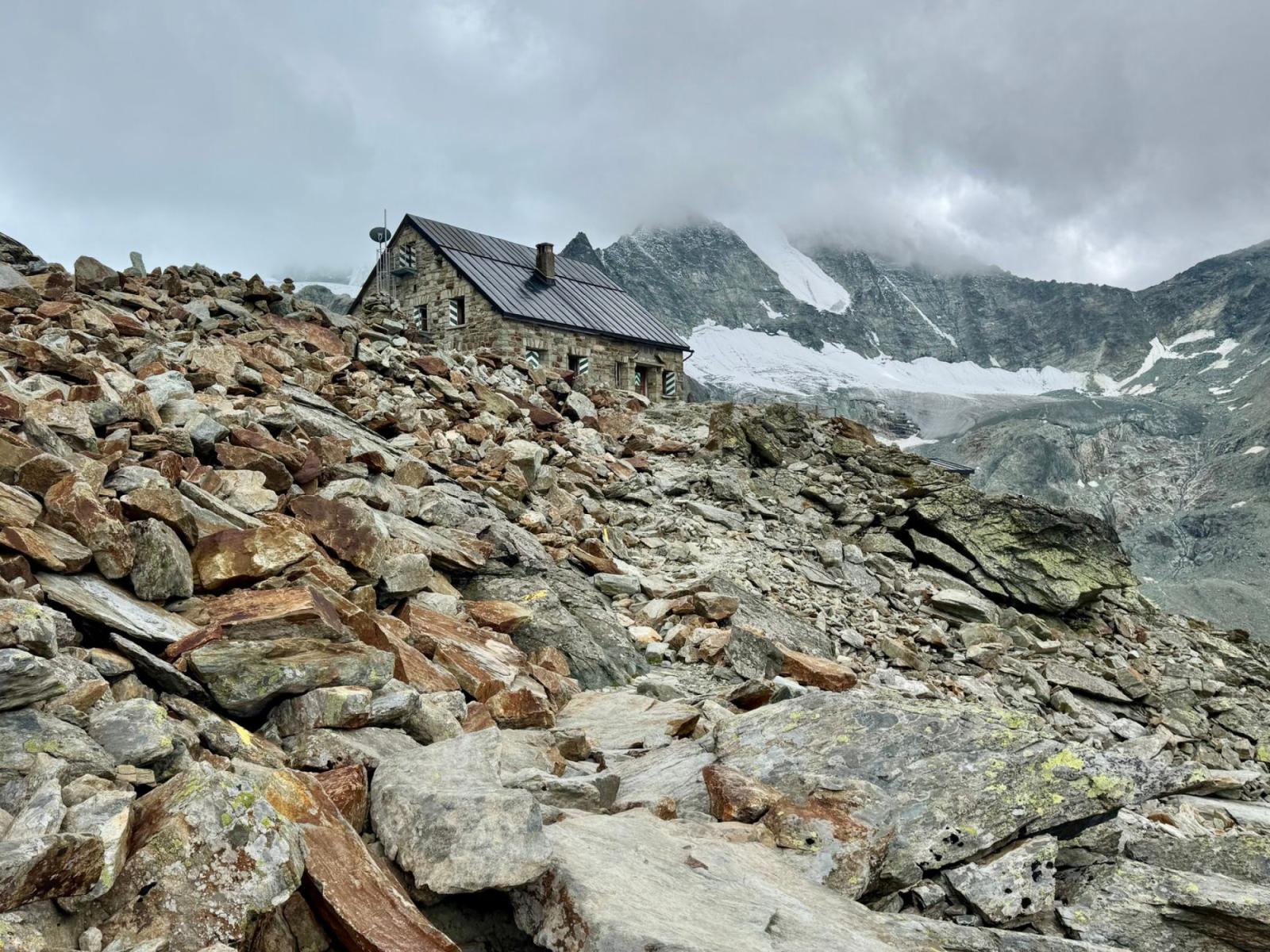
Stóg Izerski and Jizerka lie in the same mountain range, but they offer two very different kinds of refuge: the former lets you reach high ground quickly by gondola, while the latter structures the day around a settlement. That difference matters more than the length of the route itself. The same weather report can mean strong winds and visibility reduced to a few trail markers on Stóg, but a chilly yet sheltered roadside stop in Jizerka — with the option of returning without climbing onto the open ridge.
A mountain hut is therefore not merely a reward at the end of an ascent. It is also part of the terrain: it may stand on a summit, in an upland meadow, at the edge of the forest or in a settlement. Each of these locations responds differently to wind, clouds, ice and snow. Before setting out, you need to check not only whether it will rain, but also where the route ceases to be sheltered, whether there is a sensible point at which to turn back, and whether your return depends on transport.
In the mountains, the most sensible destination is not always the highest one. Sometimes it will be the hut on Stóg, sometimes Wysoki Kamień itself, and at other times Jizerka, if the cloud is descending onto the ridge and there is no reason to test it at your own expense.
Read the hut’s location first, then the temperature
A forecast for a town does not automatically describe conditions at a mountain hut. The difference in altitude changes the temperature, type of precipitation and timing of icing, but exposure is equally important. A building standing on an open ridge receives the full force of the wind. A hut in an upland meadow may be visible from a distance, yet reaching it means crossing open terrain. A settlement offers more options for shortening the day, although the surrounding paths may quickly lead out onto a plateau or pass.
The most practical division looks like this:
- summit and ridge — wind gusts, visibility and the ability to maintain your direction matter most;
- upland meadow — check whether the final section is exposed, snow-drifted or icy, even if the earlier part of the route ran through forest;
- ascent to a building on a slope — the effort increases unevenly, and conditions may deteriorate just before you reach your destination;
- settlement — it is easier to plan a meal, overnight stay or shortened outing without making decisions on an exposed section.
IMGW treats strong winds, ice, snowstorms and dense fog as separate hazards, not different names for the same weather[2]. For hikers, this means a simple rule: above-zero temperatures do not rule out ice, an absence of precipitation does not guarantee good visibility, and light winds in the valley say nothing certain about conditions on the ridge.
Before setting out, compare the forecast for a low-lying point with information for the higher parts of the mountains. Pay attention to gusts, cloud base, freezing precipitation, the possibility of fresh snow and temperature changes during the day. If a warning appears in the report, do not ask only, “Can I manage it?” Ask instead: “What kind of terrain do I want to cross today?”
Stóg Izerski: easy logistics, exposed weather
Stóg Izerski is a good example of a destination that may look simple only because the ascent can be shortened. The gondola is approximately 2,172 metres long, and its upper station is located at around 1,060 metres; Stóg itself rises to approximately 1,107 metres[3]. The hut and upper station make it possible to plan a day without the classic ascent from the centre of Świeradów-Zdrój, but they do not eliminate the issues of altitude or exposure.
On a clear day, the gondola shortens the route to the destination. On a day with a low cloud base, however, it may transport a hiker straight into conditions that could not be assessed from town. When you step out of the cabin, check whether you can see the nearest trail markers, how the wind behaves in the open space and whether the surface suddenly changes from wet to frozen. Do not assume that because the transport is operating, conditions on the ridge are suitable for continuing the hike.
The most important warning sign on Stóg is the difference between an easy approach to the building and a plan to continue onwards. The hut may be a sensible final destination even if heading further towards the border, Smrek or Polana Izerska would already require a long walk through fog or against the wind. Your goal does not have to be a loop. It can be a hot meal, a rest and the return journey, provided you have first confirmed that the gondola is operating and checked its transport rules for the conditions in question.
When should you turn back? Not only when you can no longer see the hut. Make the decision earlier if gusts are affecting your stability, cloud is concealing successive trail markers, and ice means you have to keep watching your feet. If the gondola is part of your return plan, check before setting out what you will do if its operation is suspended. Otherwise, an easy ascent may turn into a long, unplanned return.
What should you ask the hut keeper? Ask about the current condition of the road and trail, whether it is possible to continue towards the ridge you have chosen, ice on the final section and the realistic time needed to return to the upper station. If the weather is marginal, a sensible finale will be a meal and possibly an overnight stay at the hut — not because you need to extend the outing, but because the building offers the possibility of ending the walk at a high-altitude location.
Wysoki Kamień: the decision is made during the ascent
Rising to approximately 1,058 metres, Wysoki Kamień has a distinctly different character from a destination served by gondola. Granite rocks and open space appear in the summit section, while the hut itself stands in terrain that does nothing to conceal a change in the weather[4]. You do not need to plan a long expedition to feel the difference between forest and summit.
At the beginning of the ascent, observe your pace. If the group loses its rhythm on steeper sections, wet rocks require the use of your hands, and you cool down quickly at every stop, do not count on the sight of the hut automatically improving the situation. Wysoki Kamień teaches one of the most important principles of mountain decision-making: a short route on the map need not be short for tired legs, slippery soles and strong winds.
In transitional conditions, thin snow can be particularly deceptive. It conceals uneven ground and ice, but does not level the slope. On rocks it may melt earlier than in shaded forest, then form a hard, slippery layer when temperatures fall. So look not only at the colour of the ground, but also at how hikers ahead are placing their feet, signs of slipping and the places where water runs over the rocks.
When should you turn back? Before entering the more open section, if visibility is falling quickly, you have no time buffer for a calm descent and the group is beginning to split up. Do not wait until the destination is already “almost reached”. On an ascent like this, the most costly retreat is often the one made after you have gone beyond your own comfort zone, not the absence of a panorama.
What should you ask the hut keeper? Ask whether the approach from the direction you have chosen is currently icy, where the most exposed section begins and whether descending by the same route will be sensible after dark. Also check the buffet hours and the possibility of staying overnight. If the building is operating as a place to rest, a natural finale will be a hot drink, a simple meal and a descent only after assessing the conditions — not a hurried push to reach the rocks at any cost.
Hala Szrenicka and Szrenica: two destinations, one high weather threshold
In the Karkonosze Mountains, the difference between Hala Szrenicka and Szrenica is not simply a matter of which lies higher. Hala is an open sub-summit area, while Szrenica lies at approximately 1,362 metres and is among the most alpine destinations in this part of the Sudetes[5]. In both cases, you need to reckon with conditions changing more quickly than in Szklarska Poręba.
On the approach to Hala, pay attention to the point where the forest gives way to open space. If it was windless below, that does not mean the final section will be the same. On the open meadow, wind can make it difficult to maintain your direction, while cloud can remove visual reference points. The hut offers somewhere to rest, but it should not be treated as an automatic pass to the section beyond.
This is even clearer on the way to Szrenica. Reaching the building itself does not mean it is safe to continue along the main ridge. Karkonosze National Park stresses that in winter the course of some trails changes and certain sections are closed because of hazards, including avalanches; the current route should be checked before setting out, rather than based on a summer map[1].
In winter conditions, trail poles and designated diversions matter more than your memory of the route from the previous season. If the markings cease to be clear, tracks diverge in several directions and the wind is covering the hard surface, return to the last point you know for certain. Do not head onto the ridge merely to find out whether visibility will improve around the next bend.
When should you turn back? Before the open meadow or before a change in the trail route, if the KPN notice indicates a closure or winter diversion and you do not have the equipment and experience needed to move through the current conditions. Also turn back when the time needed to reach the hut begins to consume your reserve for the return. High-altitude buildings are a good finale only when the approach and descent form one logical plan.
What should you ask the hut keeper? Ask which approach is being used today, whether a winter variant is in force, where snowdrifts and ice occur, and what the possibility is of travelling between Hala Szrenicka and Szrenica. Also ask about the kitchen and overnight accommodation. In stable weather, a sensible finale may be a meal at one of the buildings and a return by the same, verified route. In fog or strong winds, the better decision will be to stop earlier, without adding a ridge section.
Jizerka: refuge in a settlement, not on an exposed slope
Jizerka is part of the Kořenov municipality on the Czech side of the Izera Mountains. It is a small settlement whose buildings are now associated mainly with tourism and dining, rather than with a single mountain hut on a summit[6]. This arrangement changes how you plan the day. You do not have to treat a single high point as a condition of a successful outing.
If the forecast shows a low cloud base, strong gusts or fresh snow on the ridges, Jizerka can be a destination in its own right. First check access, road conditions and parking, then assess whether it is worth going further. From the settlement, you can plan a shorter walk, stop for a meal or stay overnight, rather than making the entire day dependent on visibility in open terrain.
This does not mean that weather ceases to matter in Jizerka. Wet paths, ice and snow may make it more difficult to reach nearby points, and the settlement does not guarantee that every road will be passable. That is precisely why it is worth asking the hut keeper about conditions not only around the building, but also on the first exposed section of your planned route.
When should you turn back? Here, the decision can be simpler: if leaving the settlement means walking into cloud, while the main argument for continuing is a destination you decided on in advance, return to the buildings. Jizerka allows you to preserve a day in the mountains without pretending that every outing has to end on a ridge.
What should you ask the hut keeper? Ask whether the selected dining venues are open, whether overnight accommodation is available, what the return road is like and which section towards the ridge is currently most icy or covered by snowdrifts. The finale may be a local meal and an overnight stay in the settlement. In this model, refuge is not a reward after gaining altitude, but part of the infrastructure that allows you to make decisions more calmly.
How to make decisions on the trail
It is best not to wait for one dramatic warning sign. Conditions often deteriorate through the accumulation of small changes: the wind picks up, cloud descends, snow covers ice and the group begins to move increasingly slowly. Combine several observations before the situation forces you to turn back.
- Check whether the terrain matches the forecast. If it is calm in the valley but noticeably windier on the first open clearing, assume that the forecast for the higher elevations matters more than conditions by the car.
- Assess visibility in relation to navigation. If the next marker disappears, do not continue “by feel”. Fog does not have to be dense from the outset; it may appear after you cross the forest boundary.
- Distinguish snow from ice. Fresh cover may conceal hard ground. After a thaw and a drop in temperature overnight, the situation may be reversed: there is little snow, but every shaded section becomes slippery.
- Calculate the return journey before entering open terrain. If your return depends on a gondola, lift, final departure or crossing an exposed ridge, do not leave the decision until the end.
- Ask the hut keeper, but do not hand over responsibility. Information about the trail is valuable, but the final decision must take your pace, equipment and experience into account.
The best test is not whether you can “make it there”, but whether, after reaching the destination, you will have enough strength, time and orientation left for a safe return. A high-altitude hut may be an excellent destination in stable weather and a poor choice in strong gusts. A settlement may look less impressive on the map, yet in practice give you more control over the day.
That is why Stóg Izerski and Jizerka do not compete as “better” or “worse” places. You choose Stóg when altitude, transport and exposure form a coherent plan. You choose Jizerka when the ability to end the day somewhere that does not require venturing onto an exposed ridge matters more. Weather does not turn these places into different mountains. It simply changes which of them makes sense today.


