Trees at the Edge of Their Limits: How Wind, Frost and Wet Soils Shape the Forests of the Izera and Giant Mountains
A field guide to the growth forms of trees in the Izera Mountains and the Giant Mountains. Learn to read the story written by wind, frost and peatlands — from mountain pine to “flag trees” — on the ridges of Stóg Izerski, around Hala Izerska, on Wysoki Kamień, Sępia Góra and in the Szrenica area.
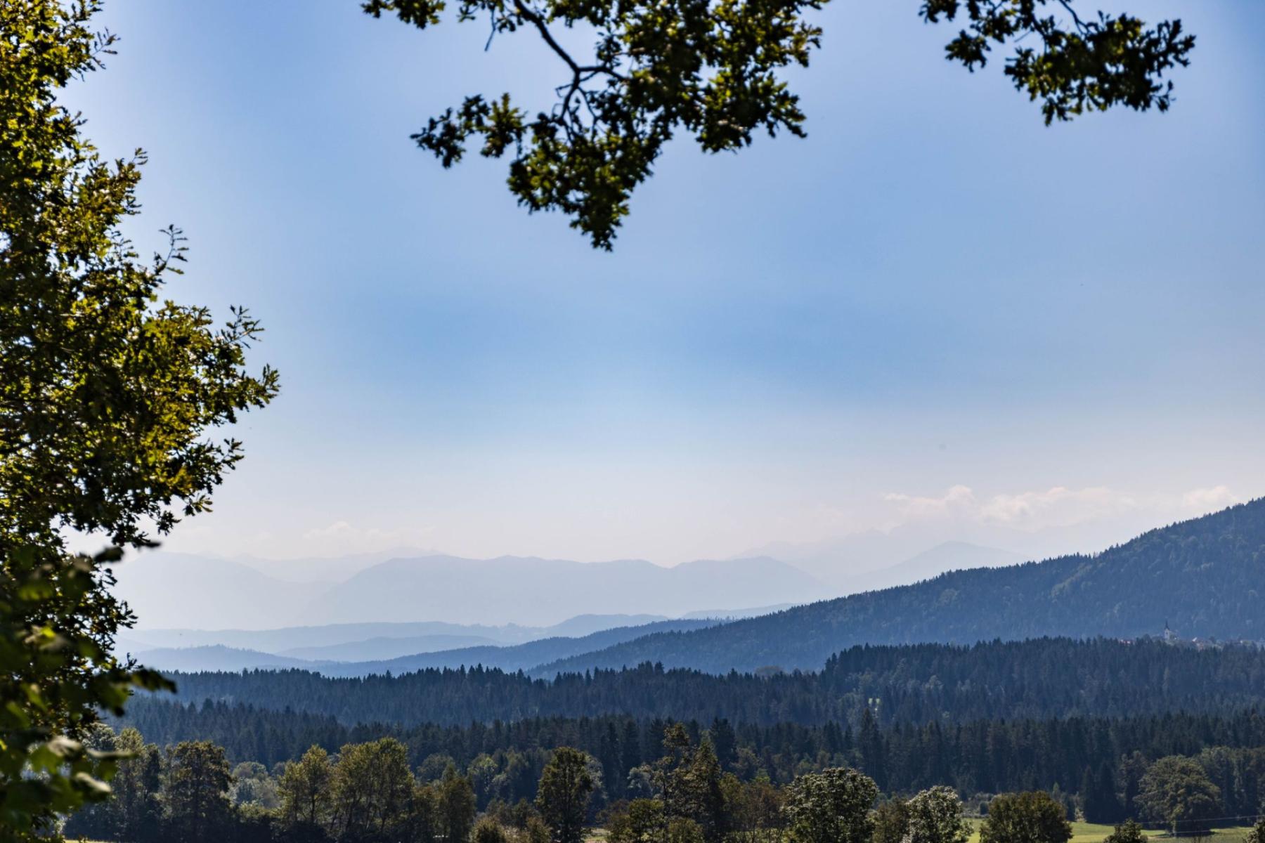
The first thing you hear high on the ridge is the wind. It tugs at your hood, bends the grasses, and plays a steady roar through spruce crowns. If you stop for a moment you’ll see it’s not just weather — it’s a sculptor. In the Izera and Giant Mountains wind, frost and wet soils carve living maps out of trees: distorted silhouettes, stunted trunks at the edge of peatlands and compact belts of mountain pine that, like a green wall, mark the forest’s limit.
The limit of possibility: where the forest ends
The upper forest line in the Giant Mountains usually runs between roughly 1,200 and 1,350 m above sea level, with small variations depending on slope aspect and prevailing winds — higher on sunny slopes, lower on cooler northern faces[1]. Above that altitude a belt begins where trees — even if they still grow — become progressively shorter, twisted, with crowns thinned on the windward side. Above that, on the open ridge, climate acts faster than the forest’s memory.
It’s here that the “language” of sculpted crowns is easiest to read: uneven growth on the leeward side, moss-dusted on the side of frequent mists, branches arranged like a coat laid in one direction. In the Giant Mountains that landscape reads like a cross-section through vegetation zones — from upper-montane spruce woods, through mountain pine, to alpine pastures and high-mountain grasslands[1].
Mountain pine: the vegetation wall of the wind
Mountain pine (Pinus mugo) doesn’t form single tops but fleshy, branched hummocks. On ridges it becomes a wall that buffers the wind, traps snow, and at the same time answers a question: why the forest no longer grows here. The density of the mountain pine is clearly visible on the Karkonosze ridge around Szrenica — trails run between compact bands of shrubs that mark the transition from spruce forest to the subalpine world[2].
Topographically the phenomenon is clear: at the edge of the mountain pine the forest “breaks up” into islands of spruce clumps, increasingly sparse with elevation. With a west wind the stems of the pine lie lower on the windward side and higher on the leeward; in winter the shrubs capture snow, forming smooth cornices. In hollows where the wind yields to cold air pools, the mountain pine gives way to peatlands or to evergreen carpets of dwarf blueberry.
Peat and water: habitat 91D0 in the heart of the Sudetes
Wet soil changes the rules of the game. At the edges of peatlands spruces become lower, crowns thin, growth weakens — the classic effect of poor, acid, constantly chilled substrate. Such places are described in the Natura 2000 network as habitat 91D0 “bog and swamp forests”, including, among others, high-mountain raised bogs with pine and mountain pine (91D0‑3) and waterlogged and peatland mountain spruce forests (91D0‑4)[3]. In practice: a stiffer carpet of peatmoss underfoot, higher humidity, more moss on trunks, and trees — stunted, bent, with paler, short annual shoots.
You feel this pattern most easily on Izerska Łąka, known as Hala Izerska. It’s an extensive, flat basin lying at roughly 840–880 m a.s.l. that acts like a cold plate — at night cold air collects here and peatlands occupy the valley floor and terraces of the Izera[4]. The Izera peatlands are protected both under Natura 2000 and on the Ramsar list, underlining the importance of these wetlands for the landscape and water retention in the Sudetes[5]. For the hiker this means simple things: watch your step, stick to the trail and the wooden walkways, and take photos from the edge — every shortcut downhill wounds the mosses.
Routes between Świeradów and the Karkonosze ridge: where to read the landscape
The Stóg Izerski ridge and the Hala Izerska area
The easiest way to reach Stóg Izerski is on foot or by the gondola from Świeradów-Zdrój — a good option when you want to reach open terrain quickly without a long ascent. Just a few minutes’ walk along the ridge shows the full alphabet of the wind: rows of spruces with crowns “combed” to one side, places where mountain pine forms tight screens, and cols where the wind accelerates like the throat of a river. The descent toward Izerska Łąka reveals the world of peatlands — lower-growing spruces, more ragged crowns, cold radiating from wet hollows. Here patience helps: sit on the meadow’s edge and watch how the grass arranges itself, how fog hangs on the mountain pine hummocks.
Wysoki Kamień and Sępia Góra
Both summits are excellent for observing “flag trees” — silhouettes that have grown like banners on masts, with branches almost exclusively on the leeward side. On the ridge the wind does the same thing day after day: it strips buds, breaks young shoots, bends trunks, and in winter coats the windward side of crowns with ice. Rocky summits add something else: in a rock crevice a drop of water and a bit of soil are a whole universe — a few mosses, a lichen, sometimes a stunted spruce or a crooked-rowan. Pay attention to the lines of bend: they record the dominant winds.
On the Karkonosze ridge: around Szrenica
Above Szklarska Poręba the ridge runs as a broad bench above the upper forest line. Here you can see three belts clearly: the upper montane below, mountain-pine bands above that, and on the crest grasslands and bare scree. From waymarked trails between the pine clumps it’s easy to spot transitions into transitional peatlands — darker patches in concave, wet hollows. This is a safe, accessible field “atlas” of processes that change whole plant communities within a short distance[2].
Field compass: what to look for
- Slope aspect. South- and west-facing slopes are warmer and drier, north-facing cooler — here the upper forest line can drop lower[1]. Face the wind and compare the height of the mountain-pine "wall" on different sides of the ridge.
- Wind direction. “Flag trees” show where the wind comes from for most of the year — longer branches are on the leeward side, the windward side is reduced to blackened “brushes.” In spruce clumps look to see if the tops are slightly “bent” in one direction.
- Site moisture. Watch for indicator plants: peatmosses, cottongrasses, bog cranberry. At peatland margins spruces dwarf, trunks are broad for their height, and crowns are narrow and sparse — a sign of habitat 91D0[3].
- Groundcover pattern. Wind-exposed ridges have a low, pressed groundcover: bilberry, burnet, turf-forming grasses; in hollows grass grows taller, often stands in water, and the groundcover is sponge-soft.
- Snow and rime lines. In winter the marker poles on the crest and the caps on mountain pine show where snow accumulates and where it’s blown away. Rime on windward branches sometimes lingers long after a thaw.
Ethics in sensitive belts
Simply put: stick to the marked trails. Above the upper forest line this rule is indisputable — in winter the ridge trails are marked by poles, and beyond them it’s easy to step into grasslands and shrublands that regenerate very slowly. Hike in daylight, don’t stray into peatlands, don’t cut across soft slopes. On both sides of the state border national park regulations apply — the framework that protects these fragile places[6].
Finally: bring not only a thermos and a windbreaker, but patience. Sit on a rock by the mountain pine, climb the windy hump of Wysoki Kamień, pause at the edge of Hala Izerska. A mindful walk will turn the landscape into process: the curve of a crown will tell of gales, miniature spruces on wet ground — of excess water and cold, and the green barriers of mountain pine — of the forest’s limits.


