Trail forecast in the Izera Mountains: how to read the microweather of Hala Izerska, Smrk and Jizerka
Between the spa basin of Świeradów and the ridges and peatlands of the Izers there can be a completely different weather. This guide teaches how to assemble a reliable picture of conditions from several sources — from the mountain service IMGW, through Czech ČHMÚ points (Jizerka, Smědava, Smrk, Bedřichov), to radars and wind maps — and how to turn a forecast into a wise decision on when to set out, which loop variant to take and how to descend safely.
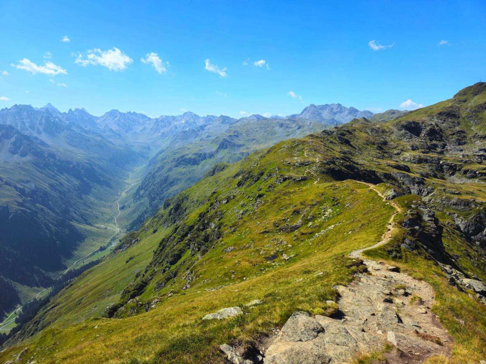
The first morning breath in Świeradów smells of resin and wet grass, but on the plateau the wind already feels different. In the spa basin there is calm, on the ridge — the whisper of wind and a chill coming from the peatlands. Two worlds, barely a few kilometres apart.
Valley vs. ridge: why the difference can be so great
Świeradów sits sheltered, while the neighbouring ridge and the open peatlands 'catch' wind and clouds. Altitude plays its part: the upper gondola station beneath Stóg Izerski is several hundred metres higher than the town — a difference you can feel in temperature and wind strength after just 10 minutes of ascent[5]. On Hala Izerska (840–880 m a.s.l.) summer can bite too: it's a classic cold basin with frequent near-ground frosts, especially on calm, cloudless nights[1]. ([skisun.pl]) ([de.wikipedia.org])
On the Czech side Jizerka plays a similar role — a small settlement lying in a cold hollow beneath Bukovec. In Czech literature such places are called "mrazová kotlina": with radiational cooling at night, cold, heavier air drains and pools in the valley bottoms, which increases amplitudes and favours fog at dawn[6]. ([de.wikipedia.org])
How to 'assemble' a forecast for the Izers: five steps, one decision
1) Start with reference points
On the Polish side the mountain service IMGW shows data and short forecasts for specific locations in the Sudetes. For an Izers outing it's worth looking in parallel at: Świeradów-Zdrój (town/valley), Polana Jakuszycka (plateau), Stóg Izerski and Wysoka Kopa (ridge). The difference between them will tell you whether the wind already 'sits' on the ridge and whether the chill is lingering over the peatlands. In the service menu you'll find these points listed under the settlement or peak name. ([gory.imgw.pl])
2) Add Czech ČHMÚ locations
Planning to go 'around the corner' to Smrek/Smrk or via Orle to Jizerka? Check the 'Jizerské hory' section in the ČHMÚ mountain forecasts: in one place you'll see Smrk, Smědava, Jizerka and Bedřichov — points that give a clear picture of wind, temperature and visibility on the southern side of the range. It's a quick filter: if Smrk and Smědava are blowing strongly, expect rough conditions on the border ridge even with a mild forecast for the town. ([en.chmi.cz])
3) Check radars and wind maps
When the forecast says 'showery', radars will clarify whether convection has already fired over the Giant Mountains and is heading toward the Izers, or whether it falls apart en route. Wind maps at surface level and at 850 hPa (on IMGW services and popular numerical visualisations) will show whether the ridge will be hit from the NW (cool, low clouds) or from the SW (warmer, but with frequent cells). Live cameras also help — though in the mountains they can be misleading about the wind. ([imgw.pl])
4) Reconcile the short and very short horizons
In the Izers two clocks work best together: 24–48 hours (the decision when to go) and 0–6 hours (whether to step into a window after the clouds or to wait out conditions in a shelter). The first clock is served by IMGW and ČHMÚ, the second by meteograms, radars and reading the wind on the ridge with your eyes.
5) Verify warnings
IMGW and ČHMÚ use three-colour scales (yellow/orange/red; in Czech: nízký/vysoký/extrémní stupeň nebezpečí). A warning indicates the risk of a phenomenon in the area — not a guarantee that a storm will 'hit' a particular trail. Treat them as an 'amplifier of caution', not as a signal to either cancel everything or to be careless.
Microweather of the Izers: phenomena you should be able to anticipate
Radiation fogs and cold pooling
Hala Izerska and Jizerka are textbook examples of places where, on a clear, windless night, temperatures in the valley bottom fall faster than on the slopes. In the morning you get a 'two-layer' landscape: sun on the ridge, milk and hoar frost on the boardwalks below. It's pure physics: nocturnal radiation loss from the ground, cold air settling, dew point, condensation — and fog that can linger for hours. Hala sometimes sees frosts in summer months, and in winter drops of many tens of degrees below zero have been recorded[1]. ([de.wikipedia.org])
Inversions: when the town is warmer than the ridge
With the arrival of stable air masses and nocturnal cooling it can happen that the ridge is warmer than the valley floor. That's an inversion: a reversed, layered temperature profile that 'locks' mixing and suppresses convective clouds. In the morning it's worth waiting until the sun 'burns through' this cover — the fog and frost on the boardwalks will clear faster and visibility will improve suddenly. ([en.wikipedia.org])
Icing in the shadow of the forest belt
Narrow bridges over streams, wooden boardwalks on peatlands, shaded cuttings and exposed saddles are points of increased risk. In winter and early spring you can get a glazed surface with invisible 'sugar' frost; in March and November — wet ice after nocturnal radiation. Stiffer-soled boots and a short 'toe test' before stepping onto a board make a difference.
Clouds by approach and wind gusts
In the western Sudetes an inflow from W and NW more often brings low, scraping clouds and drizzle on ridges, while SW (especially in summer) can quickly generate convective cells on lee slopes. Eastern and north-eastern flow clears the sky but intensifies nocturnal temperature drops in plateaus and valleys. The Izers are also exposed to gusts — it can be windy between Stóg and Smrek and on the exposed saddles above Smědava.
Key points: where to check wind and temperature
- Valley/town: Świeradów-Zdrój in the IMGW mountain service — reference for start/finish.
- Plateau and ski tracks: Polana Jakuszycka (IMGW) — wind in open space and visibility.
- Ridge (PL): Stóg Izerski (IMGW) — the real wind on the elevation; the difference versus the town often determines the comfort of the loop. The gondola to the upper station (approx. 1060 m) lets you 'catch' ridge conditions in a matter of minutes[5]. ([skisun.pl])
- Ridge (CZ): Smrk/Smrek — the highest peak of the Czech part of the Izers (1124 m); its parameters are well represented by the ČHMÚ forecast[2]. Keep in mind that the highest in the whole Izers is the Polish Wysoka Kopa (1126 m)[3]. ([en.wikipedia.org]) ([en.wikipedia.org])
- 'Around the corner' to the south: Smědava (roads and saddle), Bedřichov (ski runs and stadium), Jizerka (peatlands) in the ČHMÚ mountain forecasts — a complete set for deciding on a cross-border loop. ([en.chmi.cz])
Afternoon storms, morning windows: managing time and route variants
In summer an early start in the Izers can be priceless. Morning downslope gusts are usually weaker, clouds are broken, and although the peatlands are cold — visibility is clear. If convection is likely to 'switch on' in the afternoon, plan your loop so the highest, most exposed section falls before noon. When storm cells begin to grow from the west, you have margin to shorten the route earlier and head for a shelter or descend on a forest path.
In winter and transitional seasons exposure matters. A better descent variant is often the one 'after the sun' — fewer iced bridges and boards, more forgiving ground. Having the wind at your back on the ridge on the return saves energy for family members and tired cyclists' legs.
Cross-border and safe: how to read Czech 'výstrahy'
If your plan includes Smrk, Jizerka or Smědava, check the ČHMÚ warnings for the Liberec region. The colours and scale are intuitively aligned with the Polish ones: yellow (nízký stupeň nebezpečí), orange (vysoký) and red (extrémní). The most important elements, however, are the synoptic notes — the short comments alongside mountain forecasts often explain local nuances (e.g. "neobvyklý chod teploty" or "nízká oblačnost na hřebenech"). Read them as carefully as the icons. ([en.chmi.cz])
Hala Izerska, Smrk, Jizerka: short field notes
- Hala Izerska. An open, peat hollow at 840–880 m a.s.l., with streams of cold 'flowing' in the morning like water. In winter it can be very frosty, and frosts are by no means reserved for winter months[1]. Boardwalks and bridges can be like glass even after an August night. ([de.wikipedia.org])
- Smrk/Smrek. A steel tower, wide horizon, often a windy ridge — relief in summer, a test of the wind in winter. It is the highest peak of the Czech part of the Izers (1124 m)[2]. ([en.wikipedia.org])
- Jizerka. Stone stream thresholds, cold that lingers long after sunrise, a 'little Siberia' atmosphere. A classic mrazová kotlina; an excellent reference point for plateaus and peatlands on the Czech side[6]. ([de.wikipedia.org])
Checklist: 10 minutes before you set out
- Compare three levels: valley (Świeradów), plateau (Polana Jakuszycka), ridge (Stóg Izerski/Smrk). Differences in wind and temperature = different worlds on the trail. ([gory.imgw.pl])
- Check Jizerka and Smědava if you're going 'around the corner'. One glance at wind and visibility on the southern side. ([en.chmi.cz])
- Quick look at the radar: are cells forming over the Giant Mountains and entering the Izers? ([imgw.pl])
- Read the synoptician's comment in the ČHMÚ/IMGW mountain forecast — often more important than the icon. ([en.chmi.cz])
- Plan the loop 'in the sun' with a shortening option. Mark bridges/boardwalks and saddles on the map.
- In winter and transitional seasons — add crampons or poles. On peat boardwalks there are no soft landings.
There is no 'one weather' in the Izers. It's a system of communicating vessels: cold hollows, wind-exposed ridges, shaded forest belts and sunlit paths. Whoever understands that goes smarter.
One final topographic note. Wysoka Kopa (on the Polish side) is the highest peak of the entire Izera Mountains (1126 m), while Smrk/Smrek dominates on the Czech side (1124 m). For reading microweather that doesn't matter much — but for planning the day it does: elevation and exposure will always amplify wind and cold. If the difference between the valley and the ridge in the forecasts is 'only' a few degrees, remember about the draft and cooling on open ground[2][3]. ([en.wikipedia.org]) ([en.wikipedia.org])
When I come back from Smrek toward Hala, I like the moment when the wind dies down and the scent of moss rises from the peatlands. The Izers suddenly soften. And in that softness you can best hear how the local weather works: not in forecast pictograms, but in small differences of light, moisture and gust. If you learn to read them — with every outing you'll catch your ideal slice of the day.


