Świeradów-Zdrój by Map and Compass: How to Read the Izera Mountains While Running, Hiking and Cycling
Świeradów-Zdrój can be explored by more than just trail colours. The Spa Park, Zajęcznik, Stóg Izerski and routes leading towards the Czech Smrk become more compelling terrain when the course is determined by maps, contour lines, landmarks and decisions made in the field.
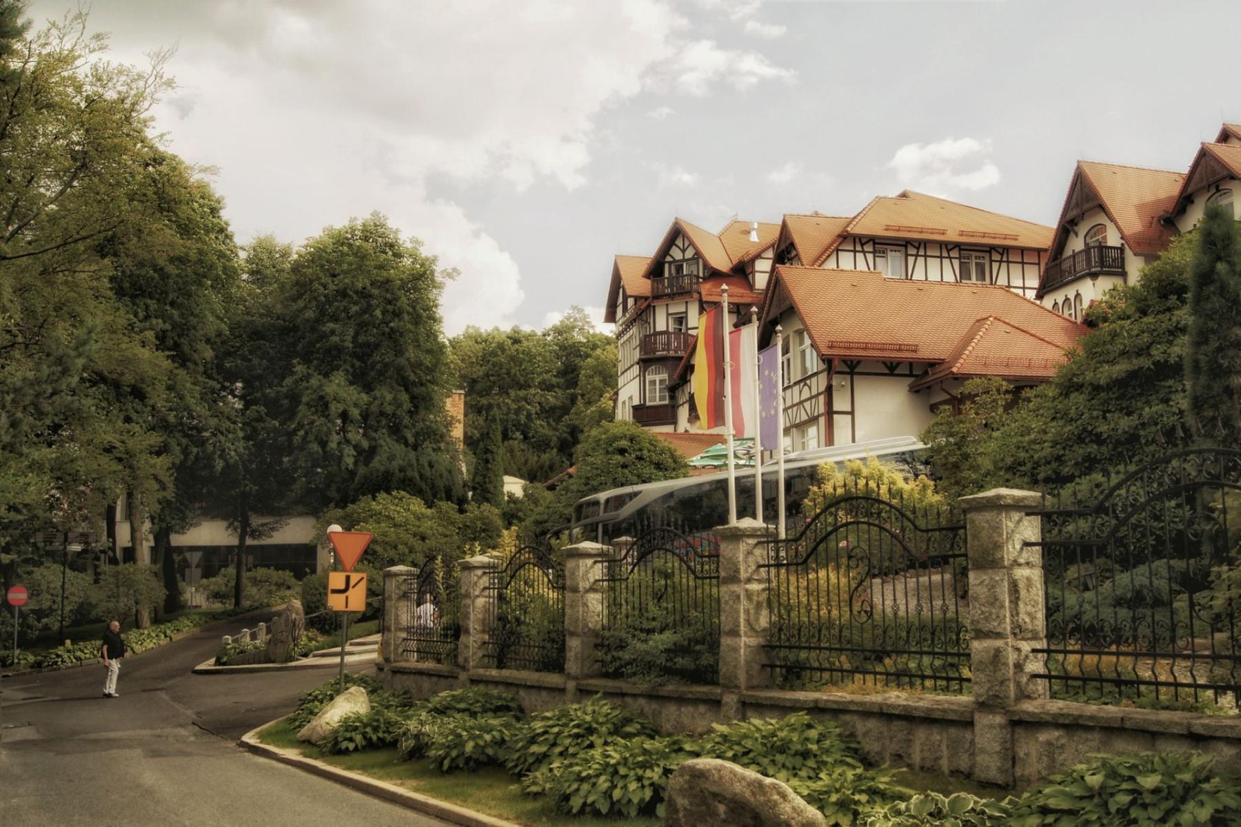
The most common mistake made by active visitors to Świeradów-Zdrój is choosing a route by the colour of its trail rather than by the task they want to accomplish. The cost is tangible: you may walk or run an attractive section, but learn nothing about the terrain. The Izera Mountains, meanwhile, are well suited to practising map-reading — from a park loop involving several decisions to a mountain option where contour lines tell you more than the trail marking.
The town provides maps categorising hiking, running, cycling and ski routes, while municipal materials also describe three levels of Runtrack routes and the rules for navigating their crossings[1]. This is not a ready-made system of permanent control points. It is, however, a good basis for independent training, a family orienteering game, or a leisurely navigation ride.
It is best to begin with a simple distinction. A classic outing involves following a chosen trail. A run-walk adds pace and effort control. Orienteering changes the objective: what matters is not only reaching the destination, but also choosing an option, orienting the map, recognising the terrain and consciously avoiding wrong turns. Recreational navigation by bike works in much the same way, but decisions must fit within the network of roads and routes available to cyclists.
Not every map serves the same purpose
A tourist map is excellent for planning an outing, but it is not always sufficient for precise navigation. It shows trails, roads, settlements and major features. An orienteering map depicts the terrain in greater detail: contour lines, watercourses, clearings, rocks, distinctive trees, fences, firebreaks and minor roads. Materials from the Świeradów Forest District also describe typical scales for orienteering maps, the meaning of colours, and the role of the compass and control points[2].
There is no need to buy a professional sports map as soon as you arrive. A tourist map with contour lines, a baseplate compass and a phone with the area saved offline will suffice. The aim of a first training session should not be to find the shortest route through the forest. It is better to practise, in sequence: orienting the map to north, recognising a ridge, identifying the nearest crossroad, assessing the steepness and choosing a place where you can safely change your route.
Your own control points can be very simple. A stone beside a crossroads, a footbridge, a fork in the road, the edge of a clearing, an information board or a distinctive bend will do, provided you mark them on the map beforehand and can recognise them without help from your phone. Do not, however, install permanent markers in the forest or move elements of the route infrastructure.
Option one: the Spa Park and Zajęcznik
The easiest training ground lies close to the centre. The Spa Park allows you to begin with short tasks in an urban and park setting. This was the location of the centre for the Polish leg of the Polish-Czech orienteering festival in 2022; the sprint stage took place in urban terrain, much of it in the park[5]. This is an important clue, but a competition map should not be confused with year-round infrastructure available to everyone.
The proposed session can last from forty minutes to an hour and a half. First, identify three points in the Spa Park: the entrance, a distinctive feature and the exit towards Zajęcznik. Then cover the section without looking at your phone, using only the map and your observations. Only on the next attempt should you add pace.
- Navigation difficulty: low at first, moderate after entering the forest.
- Visibility: good in the park, variable on Zajęcznik; in summer, some terrain features may be obscured.
- Crossings: numerous, especially around hiking, running and cycling routes.
- Turning back: very easy; you can return the way you came or descend to the built-up area.
- Who it is for: beginners, families with teenagers and runners who want to combine a warm-up with learning to read a map.
Zajęcznik is also suitable for practising elevation profiles. There is no need to analyse the entire route. Before ascending, simply identify on the map the point where the slope should level out, then check whether the terrain confirms your reading of the contour lines. You can also use the marked Runtrack routes, remembering that they are intended for pedestrians as well and that their sections intersect with cycling routes. The official rules require caution at crossings, keeping to the right on forest roads and taking your rubbish with you[1].
A game for the family
A family version should not be based on racing. Each person receives the same map and a list of five tasks: indicate the direction to the next point, count the crossings, identify the ridge, find the way back and mark a place to rest. Teenagers can lead the group for one section, while adults take over navigation when crossing busier junctions.
Option two: Stóg Izerski as a lesson in contour lines
The route from Świeradów-Zdrój to Stóg Izerski is a good place to move from park navigation to mountain navigation. The official description of the red trail gives approximately 4.5 km one way, around 2.5 hours of walking and 569 m of ascent; the destination is Stóg Izerski at an elevation of 1,105 m above sea level[4]. There is no need to cover the route quickly. In orienteering training, it is more important to stop before every major fork and answer the question: what exactly can I see on the map, and what should I see in five minutes?
On this section, it is worth practising so-called attack points. A major crossroads, a mountain hut, a clear bend in the road or the forest boundary becomes the place from which precise searching for the next point begins. Instead of running towards the destination without control, you first choose a safe feature that is easy to recognise, and only then make the short approach to the actual location.
- Navigation difficulty: moderate; it increases in poor visibility and on wet surfaces.
- Visibility: uneven; the road and major crossings are clear, but in the forest it is easy to miss a small detail.
- Crossings: fewer than on Zajęcznik, but decisions have greater consequences.
- Turning back: straightforward, provided the group records its turnaround time and retains a return option.
- Who it is for: people who have already completed a simple session near the centre.
In winter or icy conditions, do not pretend that the same training is as difficult as it is in summer. The elevation profile remains identical, but pace, visibility and reaction time change completely. The plan should include a point beyond which the group turns back regardless of how close the destination may be.
Option three: Stóg, Smrk and the border
A longer option leads towards the Czech Smrk. The town’s description of the route from Świeradów-Zdrój gives approximately 6.9 km one way, around three hours of walking and 635 m of ascent. From the section by the mountain hut on Stóg Izerski, Smrk is approximately 2.4 km away, and Smrk itself stands at 1,124 m above sea level[4]. This is no longer an exercise in quickly finding crossings. It is training in managing energy, direction and error.
On a first attempt, it is best to treat the route as a navigation hike along existing roads and trails. Mark three control points on the map: the mountain hut, the border crossing and the summit. At each one, check not only your position, but also the elevation gain, the direction of onward travel and the realistic time needed to return. If you use a digital map, your phone should confirm a decision, not make it for you.
- Navigation difficulty: moderate to high, especially in fog, precipitation or fatigue.
- Visibility: potentially broad on exposed sections, but the route should not be planned solely around the views.
- Crossings: less frequent, making it easier to miss one wrong choice and continue for a long time in the wrong direction.
- Turning back: moderate; the simplest emergency option is to retrace your steps to a known point.
- Who it is for: mountain runners, hikers and families with extensive experience in the outdoors.
Jizerka should be treated as a separate planning objective, not as an accidental extension of an outing to Smrk. Municipal materials indicate, among other options, a route from Orle across the bridge over the Jizera to Jizerka, measuring approximately 4 km[6]. If you want to combine these areas, plan in advance the starting point, border crossing, return option and the current rules in force on the Czech side.
In 2022, the Polish-Czech orienteering festival used both the slopes of Stóg Izerski and the Czech side around Nové Město pod Smrkem. The organisers described the sections as mountainous, with significant elevation gains, rocks, streams and variable runnability[5]. This confirms the region’s potential for orienteering training, but it is not proof that ready-made control points are permanently installed there. Before setting out, check the current event map or prepare your own terrain points.
How to read the Izera Mountains without guessing
Contour lines
Contour lines placed close together indicate a steeper slope, while a wide gap means gentler terrain. Closed lines may indicate a summit or a depression; the difference is determined by the shape of the terrain and the elevation values. On a ridge, contour lines often form elongated tongues; in a valley, they narrow in the direction of drainage. As you walk, check whether the terrain really descends or rises as indicated by the map.
Azimuths and guiding features
An azimuth only makes sense once the map is oriented to north. Before setting off, choose a guiding feature: a road, stream, clearing edge or ridge. Then identify an attack point — the place from which you will begin a short and precise search for your destination. This arrangement is safer than walking with a compass straight through the terrain without a plan, especially when obstacles or access restrictions are present.
Elevation profile
An elevation profile tells you more than how much uphill there will be. It shows the sequence of effort: a long ascent, a short descent, a level stretch, another step upwards. Municipal materials concerning the Runtrack distinguish three levels of route difficulty and remind users about crossings with cycle traffic[1]. On this basis, you can structure your training: a green section as a navigational warm-up, a blue one as work on decision-making, and a red one as a longer session with pace control.
Phone and emergency plan
An offline map is a backup, not an excuse for a lack of preparation. Before setting out, save the starting point, planned return time, turnaround point and two options for shortening the route. One person should have a charged phone, while another should carry a paper map or at least a written description of the basic directions. If the group stops understanding where it is, do not try to make up for the mistake by increasing the pace. Return to the last certain point.
The forest is not a course for running wherever you please
State forests are open to recreation, but with restrictions. The Świeradów Forest District lists, among other things, permanent prohibitions on entering forest plantations up to a height of 4 m, wildlife refuges, headwaters, areas at risk of erosion, experimental plots and seed stands. Temporary bans may also be introduced because of fire, windthrow, forestry work or forest protection[3].
In practice, this means that orienteering training in the Izera Mountains should be training in decision-making, not a competition to find the shortest shortcut. If the map leads through a restricted area, change your point. In protected areas, use designated trails; a marker on the map does not give you the right to leave the road[3]. Cyclists should additionally choose routes permitted for bicycles and slow down before crossings with pedestrian traffic.
The simplest weekend format looks like this: the first day in the Spa Park and on Zajęcznik, the second on Stóg Izerski or Smrk. In each option, it is not only the distance that changes, but above all the amount of information you have to process. That is what determines whether an outing becomes orienteering training.
The colour of a trail remains useful, but it is no longer the answer to every question. In Świeradów-Zdrój, a better plan begins with the map: where do I want to go, what will I recognise along the way, where can I turn back, and how will the terrain confirm my choice? Only then is it worth deciding on the pace.


