Safe Izery. A sportsperson’s rescue compass: GOPR, Horská služba and the calm water of Złotnicki
The transnational Izery are a paradise for skiing, biking and paddling — but also terrain where common sense and good procedures matter as much as fitness. This is a practical guide to calling for help on the Polish and Czech sides of the ridge, choosing shelter points and using the water of the Złotnicki Reservoir safely.
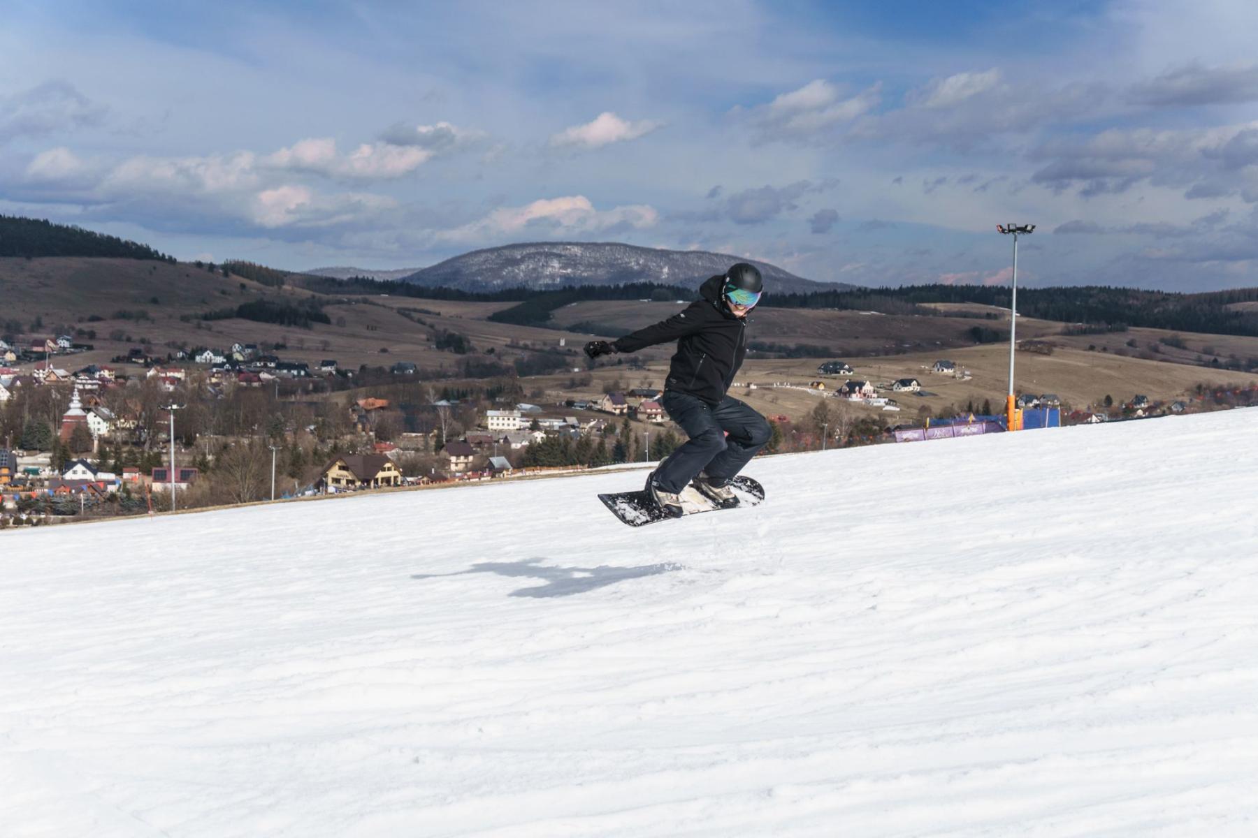
Your first thought when the wind wakes you in an Izera forest at dawn? Calm here doesn’t come from silence. It’s a mix of predictable rituals and a few decisions you make in advance: what to pack, who to notify, which number to dial if something goes wrong. The Izera Mountains — deceptively gentle — teach responsibility: on a track across Hala Izerska, in the dust of Bike Park Świeradów, on the gondola to the Ski&Sun station, or on the still surface of the Złotnicki Reservoir. The compass below is meant to guide you safely on both sides of the border.
Calling for help on the Polish side of the Izery
In the Polish mountains GOPR answers calls for help. For the visitor the practical sequence is simple: an app or a number, a short description, and a precise location. If you have signal and a smartphone, the fastest way to reach services is the free Ratunek app; alternatively call 985 or 601 100 300. You can always use 112 too — especially if you don’t know which service to choose or a joint intervention is required.[1][2]
In practice the most effective call is the one that saves time on both ends of the line. Before you call, breathe. Provide shelter for the casualty (jacket, foil blanket), secure the group. Then speak clearly.
Your simple protocol for calling help
- What? A brief description of the incident and the casualty’s condition (e.g. shoulder injury, loss of consciousness, hypothermia).
- Where? The last certain location point and your current position: trail/path name, colour and symbol, junction, marker post number, terrain feature (shelter, clearing, bridge), direction of travel/descent.
- How to recognize? Number of people, colour of jackets/helmets, type of equipment (alpine/cross-country skis, MTB, kayak/SUP).
- Contact and battery. Callback number, battery level, possibility to send location by SMS/app.
If you’re calling from the ridge — between the gondola and the clearing below Schronisko PTTK na Stogu Izerskim — precision starts with the map. In winter note marker pole numbers or distinctive route reference points (bends, piste intersections). On the singletracks below, between Świeradów and Czerniawa, remember section names and connectors. On skis toward Hala Izerska keep in mind the layout of long straights (Promenadowa, Izerska) and junctions (Rozdroże pod Cichą Równią, Polana Izerska). Shelter in the valley can be closer than you think — as long as you descend from a windy saddle to a sheltered traverse.
Don’t hesitate to ask the hut staff, a slope patrol or the gondola crew for help. For GOPR arrival time matters — every minute of good information brings rescuers closer.[1]
The Czech side of the ridge and valleys: Horská služba and number 1210
On the Czech side Horská služba České republiky operates. When your route crosses the ridge or runs through Jizerka, Bedřichov or along the Jizera, save the number 1210 in your phone with the international prefix +420 1210. This single number functions within Czech operator networks as access to the emergency lines (calls are not free on every tariff plan). In your cross-border plan have both sets of contacts saved: the Polish 985/601 100 300 and the Czech +420 1210; 112 remains the universal emergency option.[3][2]
Practical note: if your phone registers on a network across the border, the logic of that country will apply. On the ridge signal can "jump". Therefore:
- unlock the display of network status (PL/CZ) and have numbers saved with international prefixes,
- before dialing, check which network you’re registered to,
- on the other side of the border don’t rely on the Polish rescue app — choose +420 1210 or 112.[3][2]
On family-friendly border routes — from the gondola across the clearing under Schronisko PTTK na Stogu Izerskim toward Hala Izerska and on to the Czech meadows — the minimum plan is: two sets of numbers, a paper map (independent of batteries), a powerbank, a small first-aid kit, wind protection. And a clear decision: if weather on the ridge cuts visibility, descending to a sheltered forest road is a sign of maturity, not weakness.
Where to wait, how to reorganize: huts, clearings, valleys
In the Izery it’s best to reorganize plans where there is a roof or natural shelter. On the ridge the role of a "safe island" is played by Schronisko PTTK na Stogu Izerskim — easy to locate year-round and connected by a network of roads and marked paths with junctions on both sides of the ridge.[6] In winter it’s a place to shelter from the wind and regain warmth; in summer it’s a point from which to descend to Świeradów or roll toward Hala Izerska.
Hala Izerska works as a natural buffer: a wide space, clear route lines, readable forest edges. Around its margins you’ll find shelters, places to put on a warm layer, spread an NRC foil and organize group movement. In lower sections use the rest areas at trail junctions, on the edges of clearings and — if needed — near the lower gondola station and parking lots. There transport and family contact are easier.
On MTB and singletracks the boundary of common sense is visibility and speed control. If on a trail narrower than your handlebars you can’t see out of a bend — ride by sight, not by memory. Give way to pedestrians, expect uphill traffic. If a crash happens, stop off the line of travel, mark the spot (helmet on a stick, light), send one fit person for support to the nearest junction or Bike Park Świeradów station.
On skis keep two separate logics in mind: alpine skiing follows the FIS Code and a speed appropriate to crowding and visibility; on cross-country skis the track that "carries" the group has priority, and use a clear vocal signal when overtaking. Children and less experienced skiers should always ride in the middle of the "sandwich" — stronger skiers at front and rear.
Water: how to paddle safely on the Złotnicki Reservoir
The Złotnicki Reservoir is a calm, elongated bowl in the Kwisa valley. The basin was created when the river was dammed in 1924 and still serves retention and energy purposes today.[5] For paddling and SUP this means many days of quiet water — but also challenges when the narrow bowl funnels winds. At sunny noon a westerly gust can lay waves across the width, which over a longer stretch builds fatigue. So in summer paddle early morning or evening, and if you choose midday wear safety gear and plan shorter vectors with safe bays along the way.
Also remember that on Lake Złotnicki there is a ban on using watercraft powered by combustion engines, with specified exceptions (including services, fishery operations, tourist vessels, and training activities of authorised entities).[4] That’s good news for parents — less noise, fewer motorboat wakes — but also an obligation: if you see a service boat, don’t approach, give them space to work.
Three-step water protocol
- Clothing and safety. Always wear a buoyancy aid, also on a SUP. In cold water wear a wetsuit or dry layers under a windproof jacket.
- Wind and route. Check the forecast and watch the waves. Plan your route along the shore with an "escape" plan to a leeward bay.
- Communications. Phone in a waterproof case, wrist strap, location on. Before launching send loved ones an SMS with your route and planned return time.
On a board or in a kayak follow the same ethic as in the mountains: don’t paddle on ambition. If any element of the equation (weather, group, equipment) doesn’t meet the minimum — turn back.
Minimal kit: winter, summer, water
Winter (alpine/cross-country skiing)
- a small first-aid kit (sterile dressing, plaster, elastic bandage, gloves, NRC foil),
- thermal insulation: a lightweight down/synthetic in a bag, a buff and a thin hat to put on when stopped,
- light: headlamp + spare small lamp,
- communications: phone in an inner pocket, powerbank; saved numbers 985/601 100 300, 112 and (for border routes) +420 1210,[1][2][3]
- navigation: paper map in a zip pouch + offline app,
- rescue "bits": repair tape, zip ties, short cord, small knife.
Summer (MTB/singletrack, on foot)
- helmet, glasses, gloves; for the bike an inner tube/plug, pump/CO₂, multitool,
- 2–3 lights (a short spruce tunnel can be dark even in July),
- a windproof layer and thin thermal for stops,
- water and sodium (bottle/softflask; isotonic in heat),
- "communication line": who, where and until when — always inform someone close.
Water (SUP/kayak on the Złotnicki Reservoir)
- buoyancy aid (mandatory), SUP leash,
- phone in a case + clip light (flashing),
- a wind layer; in spring/autumn a wetsuit,
- app with offline map; route plan with bays to wait out conditions,
- respect for rules and the quiet zone — no combustion-powered "shortcuts".[4]
The decision to turn back is your most important safety tool. Return when: the group won’t listen, a child is tired, the wind lays you sideways on the board, the snow becomes glass-hard, or the GPS goes quiet and fog on the ridge swallows the poles. A sensible return is capital for a better-weather tomorrow.
The Izery reward those who plan boldly — and who can slow down when needed. Then even an ordinary stop at the edge of Hala Izerska has its magic: wind combs the grasses, coolness rises from wet hollows, and you feel that safety is part of the landscape just like the distant lines of spruces.
}

