Scenic drives around Świeradów: Droga Sudecka, Zakręt Śmierci and a few trail access points (including on the Czech side)
Around Świeradów-Zdrój the hairpins of the Droga Sudecka lead straight up to mountain paths: to Wysoki Kamień, via Rozdroże Izerskie, and on to the Czech Smědava and Jizerka. This is a guide for driver‑hikers: where to park legally, where to start short walks and how to stitch respectful cross‑border loops.
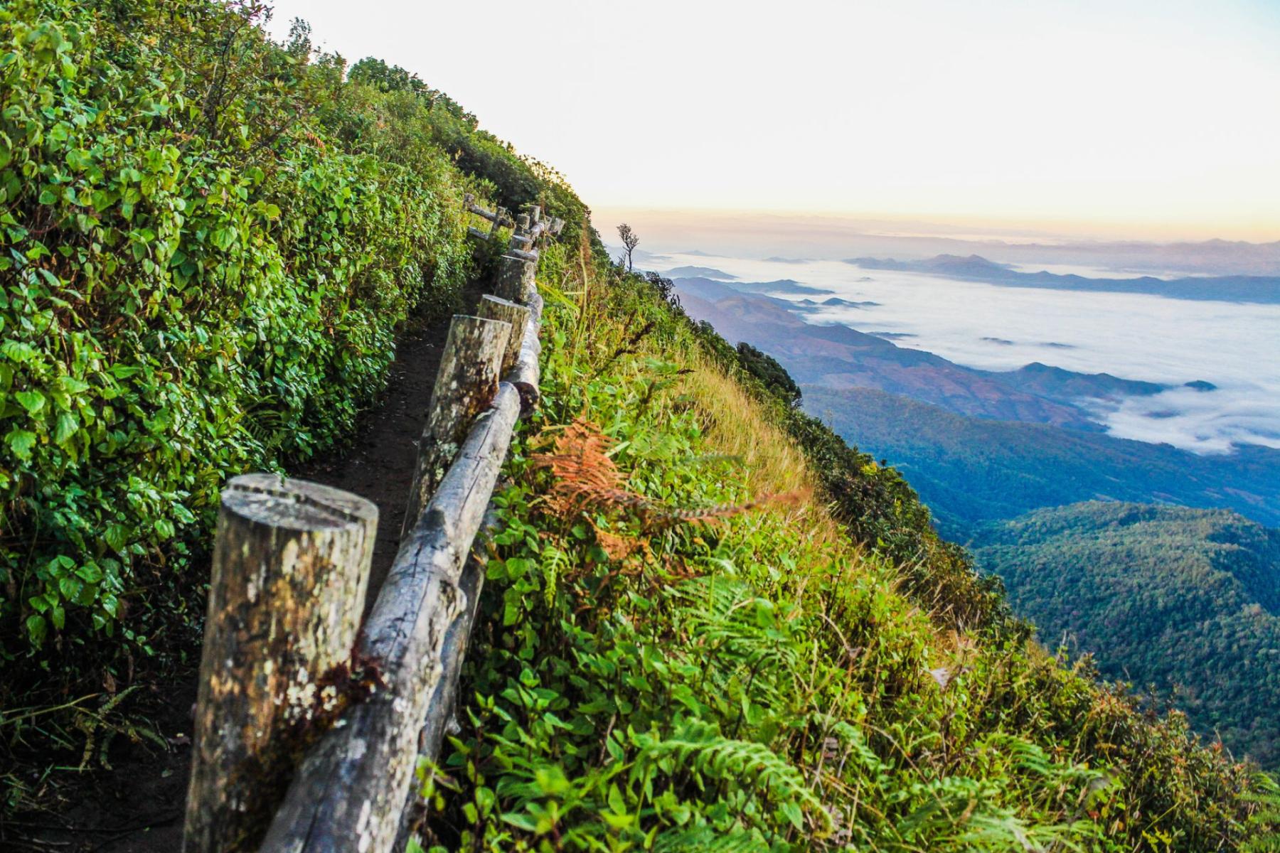
The first thing you notice rolling out from Świeradów’s spa centre is the smell of resin and the cool air slipping through an open window. The asphalt snakes between spruces, and in the dappled light of the forest avenues frames keep opening up: deep valleys, distant ridges, a high crest running to the horizon. This isn’t an ordinary access road. Around Świeradów there are routes that are sights in themselves — and they take you exactly where the best Izera and Karkonosze paths begin.
The backbone of the outing: Droga Sudecka between Świeradów and Szklarska Poręba
The stretch of Droga Sudecka linking Świeradów-Zdrój with Szklarska Poręba was built in the second half of the 1930s as part of a larger, never‑finished “Sudeten road” project. It’s a mountain road with ambition: cut across the ridge, in places on retaining walls, with belvedere‑style openings onto the Karkonosze and the Jelenia Góra Basin[1]. The climax? The famous Zakręt Śmierci — a sharp, almost semicircular bend on the ridge that today functions more as a viewpoint than the terror of old traffic reports.
If you’re planning a “from the car” hike, treat the Zakręt as a handy gate onto the trails. From here the yellow trail climbs through Czarna Góra to Wysoki Kamień (1058 m above sea level), a rocky balcony above Szklarska Poręba with a private refreshment stall and a wide panorama. This option gives a short ascent and a quick “wow” — perfect for an afternoon outing when you don’t want to be racing the daylight[2]. From the same area routes also set off toward the Zbójeckie Skały, which can turn a simple walk into a slightly longer loop “through the rocks.”
Further east, at Rozdroże Izerskie, the road clings to the ridge again. It’s a natural pass and a historic junction of paths — here the directions from the crest of Wysoki and from the lower Kamienicka arm of the Izerans meet. It’s also a good spot to “clip the loop”: ascend on one coloured trail, descend on another, returning to the car via the serpentine road, which is itself a scenic walk.
Parking and trailheads on this section
- Zakręt Śmierci: there is space near the bend for short stops. Arrive early, especially on weekends and in summer; turnover can be high, but spaces fill up fast. Respect the signs and do not block safety bays. From here you can take the yellow to Wysoki Kamień or the black/yellow route toward the Zbójeckie Skały[2].
- Rozdroże Izerskie: at the pass there are laybys and pull‑outs; use only those designated and do not drive onto forest tracks (fines and damage to nature are a decidedly poor way to start the day).
- Base in Świeradów: if you prefer to park “for sure” and reach the trailhead by bus, taxi or by taking a short descent loop, use the municipal car parks marked by the town hall (for example near the centre). Maps and listings of parking spots are published by the city’s official service.
Hikers who like red markings can immediately “jump onto” the Główny Szlak Sudecki, which starts in Świeradów and runs along the Izera ridge to Szklarska Poręba, touching, among others, Wysoka Kopa and Wysoki Kamień[3]. That makes it easy to plan clear loops: climb the yellow from the Zakręt, descend the red toward the road and return to the car via a layby or a short stretch of tarmac.
Zakręt Śmierci as a handy start: a quick big‑view from Wysoki Kamień
When over Szklarska the sun is fizzing over the roofs and granite arcades of the Karkonosze rise from the south — you can have them almost within reach from here. From the rocky outcrops of Wysoki Kamień the panorama covers both the Karkonosze ridge and the broad fan of the Izera range. The summit itself is stony and windy, with several natural terraces and a private refreshment stall that adds bustle and the smell of morning pastries[2].
The yellow trail from Zakręt Śmierci first goes through Czarna Góra — short forest “steps”, then comfortable traverses and a final stony crest. If you have more time, extend the walk west along the red ridge toward Zwalisko and the Izerskie Garby, orbiting above Droga Sudecka like a soft panoramic balcony. It’s a loop families like: reasonable effort, always clear orientation, and an easy return down the serpentine to the car afterwards.
Rozdroże Izerskie and starts “from the edge” of the ridge
Between Świeradów and Szklarska Poręba there are places where the tarmac takes you very high. Rozdroże Izerskie is one of them: a pass with character, from which trails radiate. To the south — toward the red line of the Główny Szlak Sudecki, to the north — toward the lower, quieter Kamienicka ridge. Those seeking peace often choose these northern branches: fewer people, a soft forest, the honest smell of moss after rain.
It’s also a good entry point for longer, “drive‑out” marches: coordinate two cars and do a ridge passage to Jakuszyce or Szklarska Poręba, with the driver returning for the party later. The main spine of the Izera is distinct here and well signed, with red markers leading from Świeradów all the way to the contact with the Karkonosze[3].
Czech Smědava and Jizerka: peatlands, ridges, the border footbridge
On the other side of the border there are two “entry stations” that driver‑hikers will love: Smědava and Jizerka. Smědava is a mountain saddle with a cult hut and a road through tall pinewoods; here, at roughly 847 m, stands the mountain hut (Wittighaus/Chata Smědava), and marked paths cross around it — including routes along former forest roads and a plateau with the cold springs of the Smědé[4]. Jizerka, by contrast, lies on an extensive peat meadow bounded to the south by the moraine ridge of Mořina and the cone of Bukovec. It’s a settlement with fairytale light: in the morning the grass steams, and the sky is often so clear the landscape takes on almost northern, Scandinavian hues.
The key organisational news: both Smědava and Jizerka have designated car parks. Regional information materials list, among others, Smědava and Jizerka – Pod Bukovcem (Mořina) as legal places to leave a car — marked walking and running routes start from there and lead into the plateau[6]. In season and at weekends arrive early; these are hubs hugely popular with families and cyclists.
Both locations also link neatly into cross‑border loops. The key connector is the foot bridge on the Izera between Polish Orle and Czech Jizerka — the historic Karlstaler Steg/Karlovský most, which after postwar interruptions was thoroughly renovated and reopened to traffic in 2021[5]. Through the border meadows and mosses family circuits run along wooden boardwalks and wide old tracks. It takes just a few minutes’ walk to enter the quiet world of the peatlands and listen to the burble of streams.
Parking and approaches on the Czech side
- Smědava: park on the designated area by the hut. Marked trails head off here in all directions — to Jizerka, Polední kameny, along the Na Čihadlech boardwalks toward the cross‑country trail. For families it’s a stress‑free hub: clear orientation and a quick lift into high‑mountain scenery[4][6].
- Jizerka (Mořina): use the parkoviště Mořina below the settlement and walk into Jizerka with a short stroll. From here it’s easy to make a loop crossing the border bridge and returning by forest tracks on the Polish side, for example via Orle and Hala Izerska. In the evening — if you’re staying in Świeradów — drive back the “scenic” way along the Izera ridge as the sky pales above the Smrk skyline[5][6].
Environmental note: the Polish part of the Izera valley is the "Torfowiska Doliny Izery" reserve and part of the transboundary protected area under the Ramsar Convention. Walk only on marked trails and boardwalks — peatlands are sensitive to trampling and play a crucial role in water retention in the mountains[7].
How to combine the hairpins with the gondola and mountain huts
Świeradów has another advantage for “driver‑hikers”: a gondola that lifts you up toward the Stóg Izerski area. If you’re based in town, leave the car in the centre, board the gondola and begin the day with a loud silence above the spruce crowns. From the upper station you’ll pick up the red markers of the Główny Szlak Sudecki, which runs east along the ridge; the other way gives a gentle loop toward Hala Izerska and Chatka Górzystów, after which you can descend on one of the “ferries” toward Droga Sudecka and close the day with a serpentine drive back to town[3].
This solution has several advantages: you avoid nervous circling for a parking spot under the ridge; you enter the landscape immediately, without slogging through the lower forest; and you can plan logistics easily: start on the gondola, descend to the car by the road, and finish with a short drive back to Świeradów for dinner.
Scenic car hop‑outs — short stretches, big frames
It’s not always about kilometres of walking. Sometimes the best plan is a slow “fly‑by” by car along the mountain edge, with a few short stops and 15–30‑minute strolls from a layby to a viewpoint. Note these three sequences:
- Świeradów-Zdrój → Rozdroże Izerskie → Zakręt Śmierci. A stop at the pass to feel the ridge breeze, then a “descent with a view” onto the northern slopes and a finale at the Zakręt. Stop here for a Karkonosze panorama and a quick walk on the yellow toward Czarna Góra[1][2].
- Świeradów-Zdrój → Smědava (CZ). The shortest way to drive very high and be on soft peatboardwalks five–ten minutes from the car. Notice the change in light on the way: the Czech side has a different character — wide, flat ridges and long lines of pinewoods[4][6].
- Świeradów-Zdrój → Jizerka (Mořina, CZ). Park below Bukovec, walk into the settlement and follow paths through meadows and mosses. If you have the energy, reach the border footbridge and “close” the loop via Orle. It’s a very family‑friendly plan, because the high‑mountain scenery arrives here with almost no effort[5][6][7].
Time estimates and comfort planning
For families and couples planning a day “between driving and walking” three scenarios fit well:
- Short walk + viewpoint: from the Zakręt Śmierci area to Czarna Góra and a section of the crest toward Wysoki Kamień — a simple out‑and‑back, about an hour on the ground including photo stops[2].
- Half a day on the ridge: drive the serpentine to Rozdroże Izerskie, climb the red ridge toward Hala Izerska or Zwalisko, descend on a different colour; comfortable logistics and plenty of panoramas without big elevation gains[3].
- Full‑day cross‑border loop: Jizerka – bridge on the Izera – Orle – Hala Izerska – return via Orle to the bridge and back to Jizerka. For a fit hiker it’s a “full day with a soup break”, but the route can be shortened at several points thanks to wide tracks and clear junctions[5][7].
In every option follow a simple rule: park only in designated places, and where protected areas begin stick to trails and boardwalks. These are mountains you can almost touch — and that is why they demand care.
In the spirit of “leave no trace” — where you drive, you protect
The Izera valley and the neighbouring Jizerka meadows are among the region’s most valuable natural places. The Polish part is covered by the “Torfowiska Doliny Izery” reserve and is part of a transboundary RAMSAR area; on both sides of the border the Izerski/Jizerský Dark‑Sky Park operates as well, protecting the darkness of the night sky and the unique, nearly polar qualities of the landscape[7][5]. The practice? Don’t step off the boardwalks, don’t cut switchbacks, and choose parking so you don’t scatter across the verge like a wild campsite.
You finish the day with your hands on the railing at the Zakręt Śmierci. Underfoot the fine gravel crunches, spruces smell of resin, and the main ridge darkens in the distance. These roads, these hairpins, these footbridges over the border river — let you build a day from simple blocks: a few kilometres behind the wheel, a couple of hours on foot, always with a view and always with respect for the mountains. In Świeradów it still works.


