Border singletracks: how to ride on both sides of the border — regulations, signage and customs from Świeradów to the Czech Jizerské hory
Świeradów and the Czech Singltrek pod Smrkem connect naturally: forest flow doesn't stop at a barrier. This guide explains how to read signs and difficulty colours, when to yield to a pedestrian, what the Schengen internal border means in practice and where to check local restrictions in CHKO Jizerské hory — plus a set of reliable navigation tools and how to match them with official trail maps.
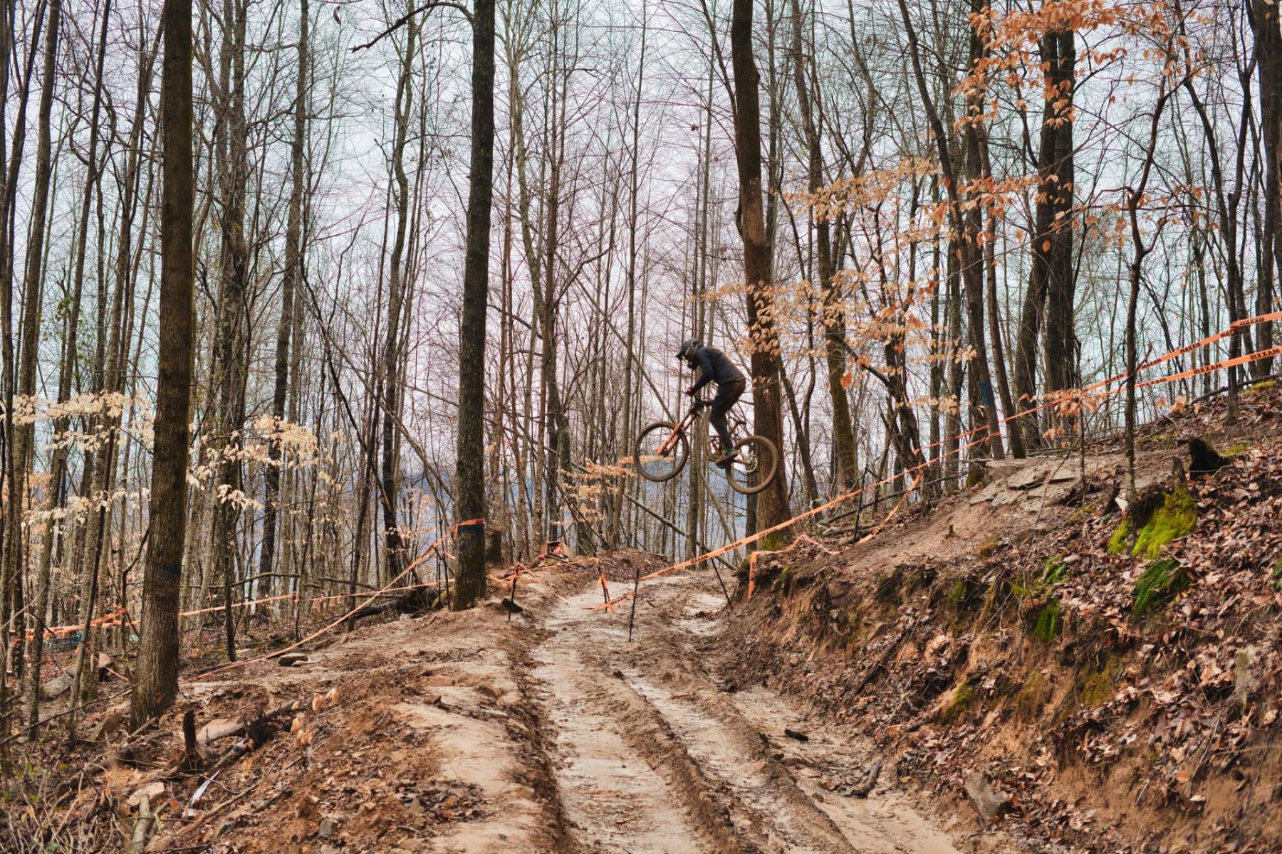
The first thing you feel on the Polish side is the resinous chill of the spruces and the sound of tyres muffled on the needles. The second is how easily that forest rhythm skips across the border. A gravel run brings you to the ridge, a short arrow with a bicycle pictogram points the way and you are already gliding along a softly banked singletrack on the Czech side. You don’t need a passport to catch the flow here. You do need to know how two trail systems work, two sets of customs and one legal order that — though shared within Schengen — can surprise you on the narrow line between the trees.
Why connect both sides? Because the best loops are born from context
The Singletrack Świeradów network, maintained by the municipality, and the Czech Singltrek pod Smrkem on the other side of Smrk (1124 m a.s.l.) form a single, long story of continuity. In practice this means you can build a loop in one day that starts in Poland, takes a "Czech" section along the ridge and returns without touching busy roads or losing the rhythm of turns. On the Polish side you ride free trails with designated direction, some sections of which may be temporarily closed due to forest works[1]. On the Czech side Singltrek organises difficulty by colours from green to black and constructs loops that naturally link together[2]. The border runs along the ridges, but the movement stays in the forest. It’s transboundary flow without tension.
Regulations and right of way: what really applies on a narrow trail
Even though you ride "in nature", the law applies. Two regulations especially shape everyday life on the Polish side singletracks. First — the definition of a bicycle. According to the Road Traffic Law, a bicycle also includes a single‑track with pedals equipped with auxiliary electric drive up to 250 W, which stops assisting at 25 km/h[3]. This is a practical tip for e‑MTB users: a legal pedelec is treated as a bicycle, not as a motor vehicle — important when a trail’s rules forbid entry to "mechanical vehicles"[1][3].
Second — right of way. If you use a "shared sidewalk and cycle path", you must ride cautiously and give priority to pedestrians. Likewise, when crossing a pedestrian path or a shared pedestrian and cycle path — slow down and yield to the pedestrian[3]. In practice, on singletracks you will most often encounter short approach sections run on forest roads and crossings with footpaths. The code does not distinguish whether you have gravel or dirt under your wheels — if you see people, you slow down and give way.
In the forest there is another layer: land managers. You must yield not only to pedestrians but also to the realities of forestry work. The Świeradów trail regulations remind that on sections run on forest roads there may be State Forest vehicles and stacked timber; routes can also be temporarily closed — obey signs and notices[1].
Signage and difficulty colours: how to read Polish boards and Czech pictograms
On the Polish side look for clear directional arrows and posts with a bicycle pictogram. The regulations require riding in the designated direction — this is key for flow and safety on a narrow, one‑way trail[1]. If you come across a warning board (steep, wet, bridges) — it’s not a generic caution. These notices follow the trail’s geometry and conditions, and every unfamiliar section should be treated as new.
On the Czech side Singltrek pod Smrkem organises difficulty with colours reminiscent of skiing: green (easiest), then blue and red, up to black (most difficult). The green route also serves as a wide, two‑way connector from the entry nodes; the others are one‑way[2]. The logic is simple: the higher the speed, the greater the technical appetite of the trail; you "dial in" difficulty with speed and line choice. When you connect systems, assume Polish signage focuses on direction and warnings, while Czech signs add a consistent difficulty scale. In both worlds the same culture applies: if you don’t know what’s around the bend, brake with margin.
How not to lose the point at the border: Schengen law in bike terms
The PL–CZ border is an internal Schengen border. That means there are no permanent border checks, but not no obligations. Always carry a valid identity document (ID card or passport) — the police in the border zone have the right to carry out identity checks on the spot. It’s simple: you ride like an EU citizen, but you must be able to identify yourself[4].
CHKO Jizerské hory: where to check restrictions and what to keep in mind
On the Czech side you ride within the CHKO Jizerské hory landscape-protected area, established on 1 January 1968 and covering over 370 km² of the Czech part of the mountains. The highest point is Smrk (1124 m a.s.l.) — you’ll recognise it by the metal observation tower rising above the spruces[5]. CHKO has its own administration (Správa CHKO), zoning and a list of reserves. What does this mean for a cyclist? Above all — stay on designated routes, check current notices from the Správa CHKO and remember that access in nature reserves may be narrower than in other parts of the area. Closures (for example due to forestry works or habitat protection) are marked in the field; respect bans and detours.
Three systems, three scenarios: examples of linking loops
1) From the Polish trailhead to the green Singltrek "entry"
Warm up on an easier loop on the Świeradów side, focusing on direction and the rhythm of turns. When you reach a node near the border, "flip" your loop onto the Czech side towards the Singltrek’s green route — a natural, two‑way connector. From there you can build a fan: blue for a long, rocking flow, red if you feel confident and want to push the pace[2]. Return along the same green axis or via a different blue variant and close the loop back on the Polish side. At crossings with footpaths and forest roads slow down and yield — it’s easy to forget in the rhythm of turns[3].
2) "Ridge mix": short but with views
Have two hours between breakfast and the spa pump room? Create a micro‑loop: a Polish section to the border, a short Czech segment and return. The secret joy of such a mix is riding at "below‑ego" speed: you travel so you can stop at any moment. You flow, but you read signs and pictograms, brake before bridges after rain, leave margin for pedestrians — rules that bind the two systems together[1][3].
3) A long day "on both sides" with a plan B
For an ambitious full‑day ride add a third system to the mix: Singletrack Glacensis. This network of loops in the Kłodzko Valley has a different character and scale — official materials speak of several dozen loops spread across the region, which helps compose longer routes in the Sudetes. In practice it’s worth starting with moderately coloured loops and reading local regulations, since each municipality managing a section has its own rules (e.g., approaches, detours or seasonal closures). Glacensis is an excellent training ground for building fitness for the next transboundary day — and the official descriptions of loops and their character will help choose the right difficulty level[6].
E‑bike at the border: when it’s a bicycle and when it’s not
Riding an e‑MTB? Good news: Polish law clearly states when an assisted cycle remains a "bicycle". The limit is 250 W continuous power, assistance only while pedalling and stopping assistance at 25 km/h. If you meet these criteria — you ride like any other biker, also on trails that officially ban "mechanical vehicles" (because you are not one). Exceed the limits — and you enter the world of mopeds, with different rules and consequences. So check the bike’s specifications before renting and don’t modify the drive for a few extra kilometres per hour[3][1].
Where to expect pedestrians and how to behave politely
Although singletracks are designed mainly for cyclists, there are contact points: short shared approaches on forest roads, junctions with red or blue footpaths, areas around nodes and parking. The rule is always the same: the pedestrian has priority on shared sections, and you are a guest on someone’s walk[3]. Show this with a bell from a distance, a calm voice, a wide line and a speed that can be called "civilised". After rain avoid aggressive braking in corners — not only for the surface, but also for people who will appear here an hour later.
Navigation: how to marry offline apps with official maps
The best loops come from a solid plan in your pocket — and offline. Do two things:
- Download official materials from the organiser. Świeradów publishes up‑to‑date network maps (e.g., "Single Track — map 2023" available for download) that show the trail layout, nodes and loop colours. It’s worth keeping them as a reference for everything you see in apps[1].
- Use general maps with an outdoor layer. Mapy.com/Mapy.cz is a popular regional portal and app for planning hiking, cycling and mountain routes with a rich tourist layer. It works globally, but in the Czech and Polish mountains it shines because it "understands" local trails, including the dense network in the Jizerské hory[7].
How to stitch this together in practice?
- In a general app (Mapy.com/Mapy.cz) plan access routes to nodes and emergency detours (in case of a closure), marking "return" points for yourself.
- Keep the official trail map stored on your phone (PDF) and in your head. It is the "authoritative source" on directions, loops and connectors for that system.
- At the PL–CZ junction add a battery margin. GPS in the forest can be hungry, and one mistake in dense conifer dim light can turn flow into an annoying gravel loop.
It’s also worth saving emergency numbers and the contact for the local tourist information (Informacja Turystyczna at Zdrojowa Street in Świeradów), where they can advise on current detours and forest conditions.
Signs that say more than you think
- Direction of travel — the foundation of a one‑way singletrack. Turning an arrow "because it suits me" ruins flow for others and increases collision risk[1].
- Difficulty scale — on the Czech side: green/blue/red/black (like on skis), with green often serving as a two‑way "corridor" to the rest of the network[2].
- Warnings — wet bridges, loose rocks, steep descents. These are not ornaments. Adjust your speed to them on an unfamiliar section.
- Closure notices — appear in the field and on managers’ websites. Don’t ignore tape and boards — detours are usually prepared[1].
Checklist of culture and safety for a transboundary loop
- Do you carry an ID/passport? In Schengen there are no permanent booths, but you must be able to identify yourself[4].
- Are you riding the designated direction? It’s not just politeness — trail profiles and drainage are designed that way[1].
- Do you see pedestrians? Slow and give way, no argument[3].
- Is your e‑bike legal? 250 W/25 km/h and assistance only while pedalling — then you are a "bicycle"[3].
- Do you have an offline plan B and saved "return" points in your head? The forest can swallow signal.
- Do you check notices from the Správa CHKO and the municipality (closures, detours)? It saves nerves and conflicts on the ground[1][5].
Sometimes the last turn of the day falls into place perfectly: a soft radius, light between trunks and that pleasant, low sound of tyres on dry needles. The border stays somewhere on the ridge, and in your head — a simple thought: the better you read signs, regulations and customs, the more freely you ride. Because trail culture can be the best amplifier of flow.


